 |
|
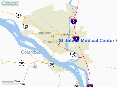
St John's Medical Center Heliport |
Location & QuickFacts
| FAA Information Effective: | 2008-09-25 |
| Airport Identifier: | 4WA3 |
| Airport Status: | Operational |
| Longitude/Latitude: | 122-56-29.0000W/46-07-49.0000N
-122.941389/46.130278 (Estimated) |
| Elevation: | 52 ft / 15.85 m (Estimated) |
| Land: | 5 acres |
| From nearest city: | 1 nautical miles E of Longview, WA |
| Location: | Cowlitz County, WA |
| Magnetic Variation: | 20E (1985) |
Owner & Manager
| Ownership: | Privately owned |
| Owner: | St John's Medical Center |
| Address: | 1615 Delaware St
Longview, WA 98632 |
| Phone number: | 360-414-2000 |
| Manager: | Mr. Francis Moenck |
| Address: | 1615 Delaware St
Longview, WA 98632 |
| Phone number: | 360-414-2000 |
Airport Operations and Facilities
| Airport Use: | Private
MEDICAL USE. |
| Wind indicator: | Yes |
| Segmented Circle: | No |
| Control Tower: | No |
| Lighting Schedule: | DUSK-DAWN |
| Sectional chart: | Seattle |
| Region: | ANM - Northwest Mountain |
| Boundary ARTCC: | ZSE - Seattle |
| Tie-in FSS: | SEA - Seattle |
| FSS on Airport: | No |
| FSS Toll Free: | 1-800-WX-BRIEF |
Runway Information
Helipad H1
| Dimension: | 40 x 40 ft / 12.2 x 12.2 m |
| Surface: | CONC, Good Condition |
| |
Runway H1 |
Runway |
| Traffic Pattern: | Left | Left |
|
Radio Navigation Aids
| ID |
Type |
Name |
Ch |
Freq |
Var |
Dist |
| AST | FAN MARKER | Fort Stevens | | | 22E | 42.9 nm |
| LSO | NDB | Kelso | | 256.00 | 21E | 1.9 nm |
| TDO | NDB | Toledo | | 219.00 | 20E | 21.4 nm |
| PEN | NDB | Karpen | | 201.00 | 20E | 26.9 nm |
| PND | NDB | Banks | | 356.00 | 21E | 30.4 nm |
| LBH | NDB | Laker | | 332.00 | 20E | 40.7 nm |
| CBU | TACAN | Columbia | 029X | | 20E | 35.4 nm |
| PDX | VOR/DME | Portland | 055X | 111.80 | 20E | 35.2 nm |
| AST | VOR/DME | Astoria | 087X | 114.00 | 19E | 39.1 nm |
| UBG | VOR/DME | Newberg | 121X | 117.40 | 21E | 46.7 nm |
| BTG | VORTAC | Battle Ground | 113X | 116.60 | 21E | 27.2 nm |
| PDX | VOT | Portland Intl | | 111.00 | | 35.0 nm |
| HIO | VOT | Portland-hillsboro | | 115.20 | | 35.4 nm |
Images and information placed above are from
http://www.airport-data.com/airport/4WA3/
We thank them for the data!
| General Info
|
| Country |
United States
|
| State |
WASHINGTON
|
| FAA ID |
4WA3
|
| Latitude |
46-07-49.000N
|
| Longitude |
122-56-29.000W
|
| Elevation |
52 feet
|
| Near City |
LONGVIEW
|
We don't guarantee the information is fresh and accurate. The data may
be wrong or outdated.
For more up-to-date information please refer to other sources.
|
|


