 |
|
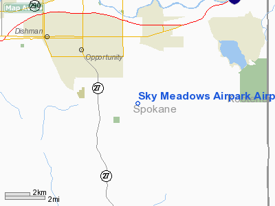
Sky Meadows Airpark Airport |
Location & QuickFacts
| FAA Information Effective: | 2008-09-25 |
| Airport Identifier: | WN92 |
| Airport Status: | Operational |
| Longitude/Latitude: | 117-10-50.7260W/47-36-30.6280N
-117.180757/47.608508 (Estimated) |
| Elevation: | 2350 ft / 716.28 m (Estimated) |
| Land: | 8 acres |
| From nearest city: | 8 nautical miles SE of Spokane, WA |
| Location: | Spokane County, WA |
| Magnetic Variation: | 19E (1985) |
Owner & Manager
| Ownership: | Privately owned |
| Owner: | Sky Meadows Airpark Assoc |
| Address: | 4901 S. Conklin
Greenacres, WA 99016 |
| Phone number: | 509-927-1194
OR CALL 509-926-1636 (EVENINGS). |
| Manager: | Rob Neils |
| Address: | South 5221 Sky Medows Lane
Greenacres, WA 99016 |
| Phone number: | 509-927-1194
OR 509-926-1636 (EVENINGS). |
Airport Operations and Facilities
| Airport Use: | Private |
| Wind indicator: | Yes |
| Segmented Circle: | No |
| Control Tower: | No |
| Lighting Schedule: | RDO-CTL
ACTVT MIRL RY 16/34 - 122.9. |
| Sectional chart: | Seattle |
| Region: | ANM - Northwest Mountain |
| Boundary ARTCC: | ZSE - Seattle |
| Tie-in FSS: | SEA - Seattle |
| FSS Toll Free: | 1-800-WX-BRIEF |
Runway Information
Runway 16/34
| Dimension: | 3300 x 100 ft / 1005.8 x 30.5 m |
| Surface: | TURF, Good Condition |
| Edge Lights: | Medium |
| |
Runway 16 |
Runway 34 |
| Traffic Pattern: | Left | Left |
| Displaced threshold: | 0.00 ft | 400.00 ft |
|
Radio Navigation Aids
| ID |
Type |
Name |
Ch |
Freq |
Var |
Dist |
| SFF | NDB | Felts | | 365.00 | 19E | 7.1 nm |
| DPY | NDB | Deer Park | | 216.00 | 19E | 23.8 nm |
| SZT | NDB | Sandpoe | | 264.00 | 20E | 47.9 nm |
| SKA | TACAN | Fairchild | 051X | | 19E | 19.5 nm |
| COE | VOR/DME | Coeur D'alene | 025X | 108.80 | 19E | 17.6 nm |
| GEG | VORTAC | Spokane | 102X | 115.50 | 21E | 18.3 nm |
| SFF | VOT | Spokane/felts Field | | 114.00 | | 7.1 nm |
| GEG | VOT | Spokane Intl | | 109.60 | | 14.6 nm |
Images and information placed above are from
http://www.airport-data.com/airport/WN92/
We thank them for the data!
| General Info
|
| Country |
United States
|
| State |
WASHINGTON
|
| FAA ID |
WN92
|
| Latitude |
47-36-30.628N
|
| Longitude |
117-10-50.726W
|
| Elevation |
2350 feet
|
| Near City |
SPOKANE
|
We don't guarantee the information is fresh and accurate. The data may
be wrong or outdated.
For more up-to-date information please refer to other sources.
|
|


