 |
|
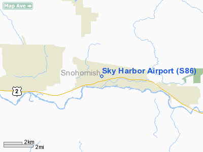
Location & QuickFacts
| FAA Information Effective: | 2008-09-25 |
| Airport Identifier: | S86 |
| Airport Status: | Operational |
| Longitude/Latitude: | 121-47-32.4320W/47-52-14.3650N
-121.792342/47.870657 (Estimated) |
| Elevation: | 282 ft / 85.95 m (Estimated) |
| Land: | 20 acres |
| From nearest city: | 1 nautical miles E of Sultan, WA |
| Location: | Snohomish County, WA |
| Magnetic Variation: | 20E (1985) |
Owner & Manager
| Ownership: | Privately owned |
| Owner: | Barry A. Hammer |
| Address: | P.o. Box 1546
Everett, WA 98201 |
| Phone number: | 425-252-8813 |
| Manager: | Kathryn Perry |
| Address: | 14310 330th Ave Se
Sultan, WA 98294 |
| Phone number: | 425-359-4625 |
Airport Operations and Facilities
| Airport Use: | Open to public |
| Wind indicator: | Yes |
| Segmented Circle: | No |
| Control Tower: | No |
| Landing fee charge: | No |
| Sectional chart: | Seattle |
| Region: | ANM - Northwest Mountain |
| Boundary ARTCC: | ZSE - Seattle |
| Tie-in FSS: | SEA - Seattle |
| FSS on Airport: | No |
| FSS Toll Free: | 1-800-WX-BRIEF |
| NOTAMs Facility: | SEA (NOTAM-d service avaliable) |
Airport Communications
| CTAF: | 122.900 |
| Unicom: | 122.800 |
Airport Services
| Airframe Repair: | NONE |
| Power Plant Repair: | NONE |
Runway Information
Runway 07/25
| Dimension: | 1930 x 100 ft / 588.3 x 30.5 m |
| Surface: | TURF, Fair Condition |
| |
Runway 07 |
Runway 25 |
| Traffic Pattern: | Left | Left |
| Obstruction: | 5 ft brush | 5 ft brush, 0.0 ft from runway |
|
Radio Navigation Aids
| ID |
Type |
Name |
Ch |
Freq |
Var |
Dist |
| RNT | NDB | Renton | | 353.00 | 20E | 28.3 nm |
| ODD | NDB | Dondo | | 224.00 | 19E | 36.9 nm |
| BVS | NDB | Skagit/bay View | | 240.00 | 21E | 43.8 nm |
| PWT | NDB | Kitsap | | 206.00 | 20E | 45.2 nm |
| NUW | TACAN | Whidbey Island | 085X | | 21E | 45.4 nm |
| PAE | VOR/DME | Paine | 043X | 110.60 | 20E | 19.8 nm |
| CVV | VOR/DME | Penn Cove | 119X | 117.20 | 19E | 43.7 nm |
| SEA | VORTAC | Seattle | 115X | 116.80 | 19E | 33.5 nm |
| BFI | VOT | Boeing Field | | 108.60 | | 29.2 nm |
| SEA | VOT | Seattle-tacoma | | 117.50 | | 33.0 nm |
Remarks
- TREES ON BOTH SIDES OF RWY IN TRANSITION AREA.
- CONTACT KATHRYN PERRY 425-359-4625 FOR FACILITY INFORMATION PRIOR TO USE.
- TREES ENCROACHING ON RWY SIDES ALONG NORTH EDGE & SOUTH EDGE AT WEST END.
- PREFERRED RY OPERATION; WIND PERMITTING LAND WEST; TAKEOFF EAST.
- AVOID ARPT DURING HIGH WIND CONDITIONS.
- NO TOUCH & GO OPERATIONS.
- NO INSTRUCTION OR STUDENT OPERATIONS.
- HELICOPTER PARKING NE END OF RY.
- WATCH FOR ANIMALS AND CHILDREN ON AND IN VICINITY OF AIRPORT.
- WEST END VERY SOFT IN WINTER AND SPRING.
- BELIVED TO EXIST PRIOR TO 1959.
Images and information placed above are from
http://www.airport-data.com/airport/S86/
We thank them for the data!
| General Info
|
| Country |
United States
|
| State |
WASHINGTON
|
| FAA ID |
S86
|
| Latitude |
47-52-14.365N
|
| Longitude |
121-47-32.432W
|
| Elevation |
282 feet
|
| Near City |
SULTAN
|
We don't guarantee the information is fresh and accurate. The data may
be wrong or outdated.
For more up-to-date information please refer to other sources.
|
|


