 |
|
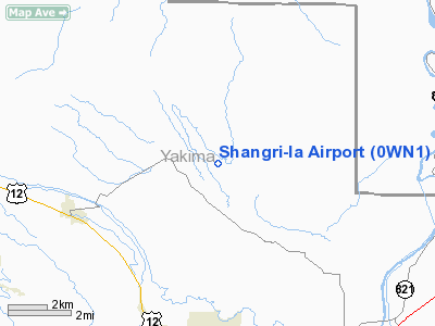
Location & QuickFacts
| FAA Information Effective: | 2008-09-25 |
| Airport Identifier: | 0WN1 |
| Airport Status: | Operational |
| Longitude/Latitude: | 120-36-06.0000W/46-45-07.0200N
-120.601667/46.751950 (Estimated) |
| Elevation: | 1500 ft / 457.20 m (Estimated) |
| Land: | 90 acres |
| From nearest city: | 7 nautical miles N of Selah, WA |
| Location: | Yakima County, WA |
| Magnetic Variation: | () |
Owner & Manager
| Ownership: | Privately owned |
| Owner: | Randy Kayle Smith |
| Address: | 251 Strunk Rd.
Washougal, WA 98671 |
| Phone number: | 360-835-2140 |
| Manager: | Randy Kayle Smith |
| Address: | 251 Strunk Rd.
Washougal, WA 98671 |
| Phone number: | 360-835-2140 |
Airport Operations and Facilities
| Airport Use: | Private |
| Wind indicator: | Yes |
| Control Tower: | No |
| Sectional chart: | Seattle |
| Region: | ANM - Northwest Mountain |
| Boundary ARTCC: | ZSE - Seattle |
| Tie-in FSS: | SEA - Seattle |
| FSS Toll Free: | 1-800-WX-BRIEF |
Runway Information
Runway 12/30
| Dimension: | 1800 x 40 ft / 548.6 x 12.2 m |
| Surface: | DIRT, |
| |
Runway 12 |
Runway 30 |
| Traffic Pattern: | Left | Left |
| Obstruction: | 100 ft pline, 1100.0 ft from runway | 30 ft hill, 500.0 ft from runway |
|
Radio Navigation Aids
| ID |
Type |
Name |
Ch |
Freq |
Var |
Dist |
| EAT | FAN MARKER | Malaga | | | 21E | 41.2 nm |
| EAT | VOR/DME | Wenatchee | 047X | 111.00 | 19E | 42.1 nm |
| YKM | VORTAC | Yakima | 107X | 116.00 | 21E | 12.7 nm |
| ELN | VORTAC | Ellensburg | 126X | 117.90 | 21E | 17.4 nm |
Images and information placed above are from
http://www.airport-data.com/airport/0WN1/
We thank them for the data!
|
|


