 |
|
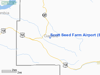
Location & QuickFacts
| FAA Information Effective: | 2008-09-25 |
| Airport Identifier: | 85WA |
| Airport Status: | Operational |
| Longitude/Latitude: | 117-45-52.7260W/46-31-35.5380N
-117.764646/46.526538 (Estimated) |
| Elevation: | 1866 ft / 568.76 m (Surveyed) |
| Land: | 0 acres |
| From nearest city: | 8 nautical miles NW of Pomeroy, WA |
| Location: | Garfield County, WA |
| Magnetic Variation: | 19E (1985) |
Owner & Manager
| Ownership: | Privately owned |
| Owner: | James A Scott |
| Address: | Box 549
Pomeroy, WA 99347-0549 |
| Phone number: | 509-843-3497 |
| Manager: | James A Scott |
| Address: | Box 549
Pomeroy, WA 99347-0549 |
| Phone number: | 509-843-3497 |
Airport Operations and Facilities
| Airport Use: | Private |
| Wind indicator: | Yes |
| Segmented Circle: | No |
| Control Tower: | No |
| Lighting Schedule: | SS-SR |
| Landing fee charge: | No |
| Sectional chart: | Seattle |
| Region: | ANM - Northwest Mountain |
| Boundary ARTCC: | ZSE - Seattle |
| Tie-in FSS: | SEA - Seattle |
| FSS on Airport: | No |
| FSS Toll Free: | 1-800-WX-BRIEF |
Runway Information
Runway 05/23
| Dimension: | 2100 x 50 ft / 640.1 x 15.2 m |
| Surface: | GRAVEL, |
| Edge Lights: | Low |
| |
Runway 05 |
Runway 23 |
| Traffic Pattern: | Left | Left |
|
Radio Navigation Aids
| ID |
Type |
Name |
Ch |
Freq |
Var |
Dist |
| PUW | VOR/DME | Pullman | 027X | 109.00 | 20E | 24.0 nm |
| ALW | VOR/DME | Walla Walla | 111X | 116.40 | 20E | 34.3 nm |
| MQG | VOR/DME | Nez Perce | 019X | 108.20 | 20E | 38.1 nm |
Images and information placed above are from
http://www.airport-data.com/airport/85WA/
We thank them for the data!
| General Info
|
| Country |
United States
|
| State |
WASHINGTON
|
| FAA ID |
85WA
|
| Latitude |
46-31-35.538N
|
| Longitude |
117-45-52.726W
|
| Elevation |
1866 feet
|
| Near City |
POMEROY
|
We don't guarantee the information is fresh and accurate. The data may
be wrong or outdated.
For more up-to-date information please refer to other sources.
|
|


