 |
|
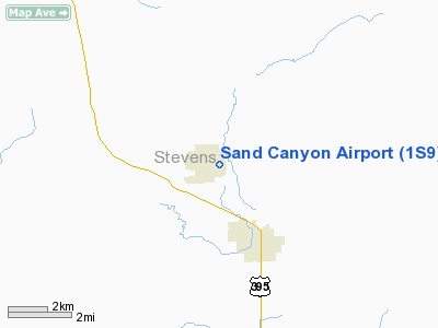
Location & QuickFacts
| FAA Information Effective: | 2008-09-25 |
| Airport Identifier: | 1S9 |
| Airport Status: | Operational |
| Longitude/Latitude: | 117-44-36.2050W/48-18-50.6890N
-117.743390/48.314080 (Estimated) |
| Elevation: | 2084 ft / 635.20 m (Estimated) |
| Land: | 0 acres |
| From nearest city: | 2 nautical miles N of Chewelah, WA |
| Location: | Stevens County, WA |
| Magnetic Variation: | 20E (1985) |
Owner & Manager
| Ownership: | Publicly owned |
| Owner: | City Of Chewelah |
| Address: | Po Box 258
Chewelah, WA 99109 |
| Phone number: | 509-935-8311 |
| Manager: | Lee Dorrance |
| Address: | Po Box 1367
Chewelah, WA 99109 |
| Phone number: | 509-935-4852 |
Airport Operations and Facilities
| Airport Use: | Open to public |
| Wind indicator: | Yes |
| Segmented Circle: | Yes |
| Control Tower: | No |
| Lighting Schedule: | DUSK-DAWN
ACTVT MIRL RY 17/35 - CTAF. |
| Beacon Color: | Clear-Green (lighted land airport) |
| Landing fee charge: | No |
| Sectional chart: | Seattle |
| Region: | ANM - Northwest Mountain |
| Boundary ARTCC: | ZSE - Seattle |
| Tie-in FSS: | SEA - Seattle |
| FSS on Airport: | No |
| FSS Toll Free: | 1-800-WX-BRIEF |
| NOTAMs Facility: | SEA (NOTAM-d service avaliable) |
Airport Communications
Airport Services
| Airframe Repair: | NONE |
| Power Plant Repair: | NONE |
| Bottled Oxygen: | NONE |
| Bulk Oxygen: | NONE |
Runway Information
Runway 17/35
| Dimension: | 3446 x 48 ft / 1050.3 x 14.6 m |
| Surface: | ASPH, Good Condition |
| Edge Lights: | Medium |
| |
Runway 17 |
Runway 35 |
| Longitude: | 117-44-31.9070W | 117-44-40.5040W |
| Latitude: | 48-19-07.4490N | 48-18-33.9280N |
| Traffic Pattern: | Right | Left |
| Markings: | Basic, Fair Condition | Basic, Fair Condition |
| Crossing Height: | 63.00 ft | 0.00 ft |
| Displaced threshold: | 230.00 ft | 101.00 ft |
| VASI: | 2-light PAPI on left side | 4-light PAPI on left side |
| Visual Glide Angle: | 4.00° | 3.00° |
| Obstruction: | 6 ft tree, 275.0 ft from runway, 63 ft right of centerline, 12:1 slope to clear
RWY 17 APCH SLOPE 50:1 TO DSPLCD THR.
3' DITCH +1' TO +3' ROCKS & RD 2' FM THR; +8' TREES 100-200' FM THR. | , 50:1 slope to clear |
|
Radio Navigation Aids
| ID |
Type |
Name |
Ch |
Freq |
Var |
Dist |
| DPY | NDB | Deer Park | | 216.00 | 19E | 24.4 nm |
| ION | NDB | Ione | | 379.00 | 21E | 27.2 nm |
| SFF | NDB | Felts | | 365.00 | 19E | 41.5 nm |
| SZT | NDB | Sandpoe | | 264.00 | 20E | 47.2 nm |
| SKA | TACAN | Fairchild | 051X | | 19E | 42.4 nm |
| COE | VOR/DME | Coeur D'alene | 025X | 108.80 | 19E | 49.3 nm |
| GEG | VORTAC | Spokane | 102X | 115.50 | 21E | 45.3 nm |
| SFF | VOT | Spokane/felts Field | | 114.00 | | 41.7 nm |
| GEG | VOT | Spokane Intl | | 109.60 | | 42.4 nm |
Remarks
- ALL PATTERNS TO THE WEST.
- DEER & WILDLIFEON & INVOF ARPT.
- PRVDD TREES ON APCH END OF RWY 17 ARE REMOVED OR RWY THR BE DSPLCD TO PRVD 20:1 OBSTN FREE APCH SFC 15' OVER SAND CANYON RD.
Images and information placed above are from
http://www.airport-data.com/airport/1S9/
We thank them for the data!
| General Info
|
| Country |
United States
|
| State |
WASHINGTON
|
| FAA ID |
1S9
|
| Latitude |
48-18-49.635N
|
| Longitude |
117-44-36.885W
|
| Elevation |
2075 feet
|
| Near City |
CHEWELAH
|
We don't guarantee the information is fresh and accurate. The data may
be wrong or outdated.
For more up-to-date information please refer to other sources.
|
|


