 |
|
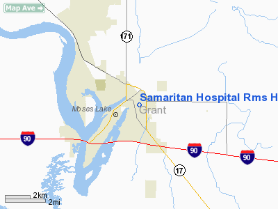
Samaritan Hospital Rms Heliport |
Location & QuickFacts
| FAA Information Effective: | 2008-09-25 |
| Airport Identifier: | WA51 |
| Airport Status: | Operational |
| Longitude/Latitude: | 119-15-51.0000W/47-07-43.0000N
-119.264167/47.128611 (Estimated) |
| Elevation: | 1130 ft / 344.42 m (Estimated) |
| Land: | 0 acres |
| From nearest city: | 0 nautical miles N of Moses Lake, WA |
| Location: | Grant County, WA |
| Magnetic Variation: | () |
Owner & Manager
| Ownership: | Privately owned |
| Owner: | Grant City Public Hospital Dist. |
| Address: | 801 E. Wheeler Rd
Moses Lake, WA 98837 |
| Phone number: | 509-765-5606 |
| Manager: | Keith Baldwin |
| Address: | 801 E. Wheeler Rd
Moses Lake, WA 98837 |
| Phone number: | 509-765-5606 |
Airport Operations and Facilities
| Airport Use: | Private
MEDICAL. |
| Wind indicator: | Yes |
| Control Tower: | No |
| Lighting Schedule: | PHONE REQ
FOR PERIMETER LGTS CALL 509-765-5606. |
| Sectional chart: | Seattle |
| Region: | ANM - Northwest Mountain |
| Boundary ARTCC: | ZSE - Seattle |
| Tie-in FSS: | SEA - Seattle |
| FSS Toll Free: | 1-800-WX-BRIEF |
Runway Information
Helipad H1
| Dimension: | 40 x 40 ft / 12.2 x 12.2 m |
| Surface: | CONC, |
| |
Runway H1 |
Runway |
| Traffic Pattern: | Left | Left |
|
Radio Navigation Aids
| ID |
Type |
Name |
Ch |
Freq |
Var |
Dist |
| EAT | FAN MARKER | Malaga | | | 21E | 38.2 nm |
| MW | NDB | Pelly | | 408.00 | 18E | 0.9 nm |
| MWH | VOR/DME | Moses Lake | 097X | 115.00 | 18E | 5.4 nm |
| EAT | VOR/DME | Wenatchee | 047X | 111.00 | 19E | 41.9 nm |
| EPH | VORTAC | Ephrata | 073X | 112.60 | 21E | 16.3 nm |
| ELN | VORTAC | Ellensburg | 126X | 117.90 | 21E | 49.3 nm |
Images and information placed above are from
http://www.airport-data.com/airport/WA51/
We thank them for the data!
|
|


