 |
|
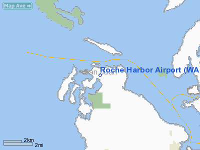
Location & QuickFacts
| FAA Information Effective: | 2008-09-25 |
| Airport Identifier: | WA09 |
| Airport Status: | Operational |
| Longitude/Latitude: | 123-08-18.6720W/48-36-44.3580N
-123.138520/48.612322 (Estimated) |
| Elevation: | 100 ft / 30.48 m (Estimated) |
| Land: | 0 acres |
| From nearest city: | 1 nautical miles NE of Roche Harbor, WA |
| Location: | San Juan County, WA |
| Magnetic Variation: | 21E (1985) |
Owner & Manager
| Ownership: | Privately owned |
| Owner: | Roche Harbor Airport Inc |
| Address: | 8484 Roche Harbor Road
Friday Harbor, WA 98250 |
| Phone number: | 360-378-3500 |
| Manager: | David Gibbs |
| Address: | 8484 Roche Harbor Road
Friday Harbor, WA 98250 |
| Phone number: | 360-378-3500 |
Airport Operations and Facilities
| Airport Use: | Private |
| Wind indicator: | Yes |
| Segmented Circle: | No |
| Control Tower: | No |
| Lighting Schedule: | DUSK-2200 |
| Landing fee charge: | Yes |
| Sectional chart: | Seattle |
| Region: | ANM - Northwest Mountain |
| Boundary ARTCC: | ZSE - Seattle |
| Responsible ARTCC: | ZVR - Vancouver |
| Tie-in FSS: | SEA - Seattle |
| FSS on Airport: | No |
| FSS Toll Free: | 1-800-WX-BRIEF |
Airport Services
| Airframe Repair: | NONE |
| Power Plant Repair: | NONE |
| Bottled Oxygen: | NONE |
| Bulk Oxygen: | NONE |
Runway Information
Runway 07/25
| Dimension: | 3593 x 30 ft / 1095.1 x 9.1 m |
| Surface: | ASPH, Fair Condition |
| Edge Lights: | Non-standard lighting system
RY 07/25 NSTD LIRL, ONLY CENTER 2700 FT OF RY IS LGTD. |
| |
Runway 07 |
Runway 25 |
| Traffic Pattern: | Left | Left |
| Markings: | Basic, Fair Condition | Basic, Fair Condition |
| Displaced threshold: | 587.00 ft | 92.00 ft |
| Obstruction: | 160 ft tree, 1136.0 ft from runway, 75 ft left of centerline | 30 ft hill, 200.0 ft from runway |
|
Radio Navigation Aids
| ID |
Type |
Name |
Ch |
Freq |
Var |
Dist |
| FHR | NDB | Friday Harbor | | 284.00 | 20E | 6.8 nm |
| YJ | NDB | Victoria | | 200.00 | 21E | 10.5 nm |
| OPZ | NDB | Lopez Island | | 356.00 | 21E | 11.8 nm |
| MB | NDB | Mill Bay | | 293.00 | 21E | 16.2 nm |
| AP | NDB | Active Pass | | 378.00 | 21E | 16.8 nm |
| WC | NDB | White Rock | | 332.00 | 21E | 28.4 nm |
| BVS | NDB | Skagit/bay View | | 240.00 | 21E | 29.9 nm |
| VR | NDB | Vancouver | | 266.00 | 21E | 33.8 nm |
| CL | NDB | Elwha | | 515.00 | 22E | 35.0 nm |
| V | NDB | Victor | | 368.00 | 22E | 35.0 nm |
| XX | NDB | Abbotsford | | 344.00 | 21E | 35.4 nm |
| YCD | NDB | Nanaimo | | 251.00 | 21E | 42.4 nm |
| LU | NDB | Cultus | | 214.00 | 22E | 49.6 nm |
| NUW | TACAN | Whidbey Island | 085X | | 21E | 24.5 nm |
| YYJ | VOR/DME | Victoria | 084X | 113.70 | 21E | 15.4 nm |
| CVV | VOR/DME | Penn Cove | 119X | 117.20 | 19E | 27.6 nm |
| YVR | VORTAC | Vancouver | 44 | 115.90 | 21E | 28.0 nm |
| HUH | VORTAC | Whatcom | 077X | 113.00 | 20E | 29.9 nm |
Remarks
- NO LINE OF SIGHT BTN RY ENDS. PILOTS MAINTAIN COMMS ON FREQ 128.25 WITH LDG LGTS ON.
- NO PARKING ON GRASS DURG RAINY SEASON NOV-APR.
- MEDIVAC ACFT HAVE PRIORITY USE OF ARPT.
- NGT OPNS NOT RECOMMENDED.
- DRAINAGE DITCH N. SIDE RY 30 FT FM RY EDGE.
- NO INTERSECTION DEPARTURES FROM TWY C.
Images and information placed above are from
http://www.airport-data.com/airport/WA09/
We thank them for the data!
| General Info
|
| Country |
United States
|
| State |
WASHINGTON
|
| FAA ID |
WA09
|
| Latitude |
48-36-44.358N
|
| Longitude |
123-08-18.672W
|
| Elevation |
100 feet
|
| Near City |
ROCHE HARBOR
|
We don't guarantee the information is fresh and accurate. The data may
be wrong or outdated.
For more up-to-date information please refer to other sources.
|
|


