 |
|
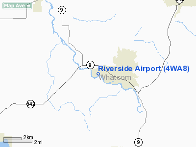
Location & QuickFacts
| FAA Information Effective: | 2008-09-25 |
| Airport Identifier: | 4WA8 |
| Airport Status: | Operational |
| Longitude/Latitude: | 122-15-51.5690W/48-50-05.4160N
-122.264325/48.834838 (Estimated) |
| Elevation: | 175 ft / 53.34 m (Estimated) |
| Land: | 89 acres |
| From nearest city: | 3 nautical miles W of Deming, WA |
| Location: | Whatcom County, WA |
| Magnetic Variation: | 20E (1995) |
Owner & Manager
| Ownership: | Privately owned |
| Owner: | Douglas Sande |
| Address: | 5376 Mariotto Road
Everson, WA 98247 |
| Phone number: | 206-592-2954 |
| Manager: | Doug Sande |
| Address: | 5376 Mariotto Road
Everson, WA 98247 |
| Phone number: | 206-671-3688 |
Airport Operations and Facilities
| Airport Use: | Private |
| Segmented Circle: | Yes |
| Control Tower: | No |
| Sectional chart: | Seattle |
| Region: | ANM - Northwest Mountain |
| Boundary ARTCC: | ZSE - Seattle |
| Tie-in FSS: | SEA - Seattle |
| FSS on Airport: | No |
| FSS Toll Free: | 1-800-WX-BRIEF |
Runway Information
Runway 07/25
| Dimension: | 2200 x 80 ft / 670.6 x 24.4 m |
| Surface: | TURF, |
| |
Runway 07 |
Runway 25 |
| Traffic Pattern: | Left | Left |
| Obstruction: | 50 ft pline, 150.0 ft from runway | 75 ft trees, 150.0 ft from runway |
|
Radio Navigation Aids
| ID |
Type |
Name |
Ch |
Freq |
Var |
Dist |
| XX | NDB | Abbotsford | | 344.00 | 21E | 14.0 nm |
| LU | NDB | Cultus | | 214.00 | 22E | 14.1 nm |
| WC | NDB | White Rock | | 332.00 | 21E | 21.1 nm |
| BVS | NDB | Skagit/bay View | | 240.00 | 21E | 22.9 nm |
| OPZ | NDB | Lopez Island | | 356.00 | 21E | 33.7 nm |
| FHR | NDB | Friday Harbor | | 284.00 | 20E | 35.5 nm |
| VR | NDB | Vancouver | | 266.00 | 21E | 37.3 nm |
| AP | NDB | Active Pass | | 378.00 | 21E | 40.6 nm |
| V | NDB | Victor | | 368.00 | 22E | 43.3 nm |
| YJ | NDB | Victoria | | 200.00 | 21E | 46.4 nm |
| HE | NDB | Hope | | 245.00 | 21E | 46.8 nm |
| NUW | TACAN | Whidbey Island | 085X | | 21E | 32.9 nm |
| CVV | VOR/DME | Penn Cove | 119X | 117.20 | 19E | 39.9 nm |
| YYJ | VOR/DME | Victoria | 084X | 113.70 | 21E | 48.8 nm |
| HUH | VORTAC | Whatcom | 077X | 113.00 | 20E | 14.1 nm |
| YVR | VORTAC | Vancouver | 44 | 115.90 | 21E | 37.8 nm |
Remarks
- PRVDD PVT USE VFR/DALGHT OPERATIONS ONLY.
Images and information placed above are from
http://www.airport-data.com/airport/4WA8/
We thank them for the data!
| General Info
|
| Country |
United States
|
| State |
WASHINGTON
|
| FAA ID |
4WA8
|
| Latitude |
48-50-05.416N
|
| Longitude |
122-15-51.569W
|
| Elevation |
175 feet
|
| Near City |
DEMING
|
We don't guarantee the information is fresh and accurate. The data may
be wrong or outdated.
For more up-to-date information please refer to other sources.
|
|


