 |
|
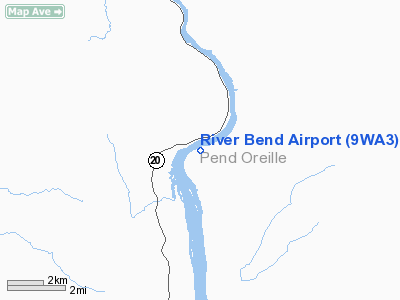
Location & QuickFacts
| FAA Information Effective: | 2008-09-25 |
| Airport Identifier: | 9WA3 |
| Airport Status: | Operational |
| Longitude/Latitude: | 117-17-23.8100W/48-28-10.6740N
-117.289947/48.469632 (Estimated) |
| Elevation: | 2040 ft / 621.79 m (Estimated) |
| Land: | 0 acres |
| From nearest city: | 9 nautical miles N of River Bend Lodge, WA |
| Location: | Pend Oreille County, WA |
| Magnetic Variation: | 20E (1985) |
Owner & Manager
| Ownership: | Privately owned |
| Owner: | River Bend Inc |
| Address: | Rt 2
Usk, WA 99180 |
| Phone number: | 509-445-1142 |
| Manager: | Jerry Dilling |
| Address: | Rt 2
Usk, WA 99180 |
| Phone number: | 509-445-1142 |
Airport Operations and Facilities
| Airport Use: | Private |
| Wind indicator: | Yes |
| Segmented Circle: | No |
| Control Tower: | No |
| Landing fee charge: | No |
| Sectional chart: | Seattle |
| Region: | ANM - Northwest Mountain |
| Boundary ARTCC: | ZSE - Seattle |
| Tie-in FSS: | SEA - Seattle |
| FSS on Airport: | No |
| FSS Toll Free: | 1-800-WX-BRIEF |
Airport Communications
Airport Services
Runway Information
Runway 03/21
| Dimension: | 3750 x 60 ft / 1143.0 x 18.3 m
DIAMETER OF CIRCULAR LNDG/TKOF AREA. |
| Surface: | TURF-DIRT, Poor Condition
ROUGH & UNEVEN; SOFT WHEN WET. |
| |
Runway 03 |
Runway 21 |
| Traffic Pattern: | Left | Right |
| Obstruction: | 160 ft trees, 150.0 ft from runway | 3 ft fence, 0.0 ft from runway, 30 ft left of centerline |
|
Runway 04W/22W
| Dimension: | 5000 x 100 ft / 1524.0 x 30.5 m
DIAMETER OF CIRCULAR LNDG/TKOF AREA. |
| Surface: | WATER,
ROUGH & UNEVEN; SOFT WHEN WET. |
| |
Runway 04W |
Runway 22W |
| Traffic Pattern: | Left | Right |
| Obstruction: | 1000 ft hill, 10000.0 ft from runway, 10:1 slope to clear | 680 ft hill, 4000.0 ft from runway, 5:1 slope to clear |
|
Helipad H1
| Dimension: | 50 x 50 ft / 15.2 x 15.2 m
DIAMETER OF CIRCULAR LNDG/TKOF AREA. |
| Surface: | TURF, Fair Condition
ROUGH & UNEVEN; SOFT WHEN WET. |
| |
Runway H1 |
Runway |
| Traffic Pattern: | Left | Left |
|
Radio Navigation Aids
| ID |
Type |
Name |
Ch |
Freq |
Var |
Dist |
| ION | NDB | Ione | | 379.00 | 21E | 15.3 nm |
| DPY | NDB | Deer Park | | 216.00 | 19E | 30.7 nm |
| SZT | NDB | Sandpoe | | 264.00 | 20E | 30.9 nm |
| SFF | NDB | Felts | | 365.00 | 19E | 47.1 nm |
| EF | NDB | Champion | | 206.00 | 20E | 49.2 nm |
| COE | VOR/DME | Coeur D'alene | 025X | 108.80 | 19E | 45.9 nm |
| SFF | VOT | Spokane/felts Field | | 114.00 | | 47.5 nm |
Remarks
- NE END RY 03 UNMKD; LND AT BOTTOM OF HILL BYD WINDSOCK; ROAD FM THR RY 21 TO BLDGS UPSLOPE AT 5 DEG GRADE.
- 4' FENCE EACH SIDE OF RY AT RY EDGES.
- DETERMINATION PENDING.
Images and information placed above are from
http://www.airport-data.com/airport/9WA3/
We thank them for the data!
| General Info
|
| Country |
United States
|
| State |
WASHINGTON
|
| FAA ID |
9WA3
|
| Latitude |
48-28-10.674N
|
| Longitude |
117-17-23.810W
|
| Elevation |
2040 feet
|
| Near City |
RIVER BEND LODGE
|
We don't guarantee the information is fresh and accurate. The data may
be wrong or outdated.
For more up-to-date information please refer to other sources.
|
|


