 |
|
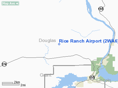
Location & QuickFacts
| FAA Information Effective: | 2008-09-25 |
| Airport Identifier: | 2WA6 |
| Airport Status: | Operational |
| Longitude/Latitude: | 119-05-19.0930W/47-59-53.5450N
-119.088637/47.998207 (Estimated) |
| Elevation: | 2434 ft / 741.88 m (Estimated) |
| Land: | 0 acres |
| From nearest city: | 7 nautical miles NW of Grand Coulee, WA |
| Location: | Douglas County, WA |
| Magnetic Variation: | 20E (1985) |
Owner & Manager
| Ownership: | Privately owned |
| Owner: | Richard Rice |
| Address: | 2601 Smith Lake Road
Grand Coulee, WA 99133 |
| Phone number: | 509-633-0182 |
| Manager: | Richard Rice |
| Address: | 2601 Smith Lake Road
Grand Coulee, WA 99133 |
| Phone number: | 509-633-0182 |
Airport Operations and Facilities
| Airport Use: | Private |
| Wind indicator: | Yes |
| Segmented Circle: | No |
| Control Tower: | No |
| Landing fee charge: | No |
| Sectional chart: | Seattle |
| Region: | ANM - Northwest Mountain |
| Boundary ARTCC: | ZSE - Seattle |
| Tie-in FSS: | SEA - Seattle |
| FSS on Airport: | No |
| FSS Toll Free: | 1-800-WX-BRIEF |
Runway Information
Runway 07/25
| Dimension: | 1800 x 30 ft / 548.6 x 9.1 m |
| Surface: | GRVL, |
| |
Runway 07 |
Runway 25 |
| Traffic Pattern: | Left | Left |
| Obstruction: | 80 ft pline, 1300.0 ft from runway | |
|
Radio Navigation Aids
| ID |
Type |
Name |
Ch |
Freq |
Var |
Dist |
| OMK | NDB | Omak | | 219.00 | 19E | 32.3 nm |
| MWH | VOR/DME | Moses Lake | 097X | 115.00 | 18E | 48.2 nm |
| EPH | VORTAC | Ephrata | 073X | 112.60 | 21E | 39.7 nm |
Images and information placed above are from
http://www.airport-data.com/airport/2WA6/
We thank them for the data!
| General Info
|
| Country |
United States
|
| State |
WASHINGTON
|
| FAA ID |
2WA6
|
| Latitude |
47-59-53.545N
|
| Longitude |
119-05-19.093W
|
| Elevation |
2434 feet
|
| Near City |
GRAND COULEE
|
We don't guarantee the information is fresh and accurate. The data may
be wrong or outdated.
For more up-to-date information please refer to other sources.
|
|


