 |
|
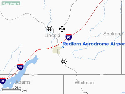
Redfern Aerodrome Airport |
Location & QuickFacts
| FAA Information Effective: | 2008-09-25 |
| Airport Identifier: | WN41 |
| Airport Status: | Operational |
| Longitude/Latitude: | 117-57-42.0000W/47-18-16.0000N
-117.961667/47.304444 (Estimated) |
| Elevation: | 2050 ft / 624.84 m (Estimated) |
| Land: | 24 acres |
| From nearest city: | 1 nautical miles NE of Sprague, WA |
| Location: | Lincoln County, WA |
| Magnetic Variation: | () |
Owner & Manager
| Ownership: | Privately owned |
| Owner: | Redfern Aerodrome Llc |
| Address: | 205 Pike Pl
Sequim, WA 98382 |
| Phone number: | 360-683-8000 |
| Manager: | Patrick W. Rose |
| Address: | 205 Pike Pl
Sequim, WA 98382 |
| Phone number: | 360-683-8000 |
Airport Operations and Facilities
| Airport Use: | Private |
| Wind indicator: | Yes |
| Control Tower: | No |
| Sectional chart: | Klamath Falls |
| Region: | ANM - Northwest Mountain |
| Boundary ARTCC: | ZSE - Seattle |
| Tie-in FSS: | SEA - Seattle |
| FSS Toll Free: | 1-800-WX-BRIEF |
Runway Information
Runway 07/25
| Dimension: | 2500 x 50 ft / 762.0 x 15.2 m |
| Surface: | ASPH/GRVL, Fair Condition
RY 07/25 WEST 1000 FT ASPH X 16 FT WIDE, EAST 1500 FT GRVL X 50 FT WIDE. |
| |
Runway 07 |
Runway 25 |
| Traffic Pattern: | Left | Left |
| Obstruction: | 5 ft fence, 50.0 ft from runway | 5 ft fence, 50.0 ft from runway |
|
Radio Navigation Aids
| ID |
Type |
Name |
Ch |
Freq |
Var |
Dist |
| SFF | NDB | Felts | | 365.00 | 19E | 35.0 nm |
| DPY | NDB | Deer Park | | 216.00 | 19E | 45.4 nm |
| SKA | TACAN | Fairchild | 051X | | 19E | 22.1 nm |
| PUW | VOR/DME | Pullman | 027X | 109.00 | 20E | 48.5 nm |
| GEG | VORTAC | Spokane | 102X | 115.50 | 21E | 20.7 nm |
| GEG | VOT | Spokane Intl | | 109.60 | | 25.7 nm |
| SFF | VOT | Spokane/felts Field | | 114.00 | | 34.5 nm |
Images and information placed above are from
http://www.airport-data.com/airport/WN41/
We thank them for the data!
|
|


