 |
|
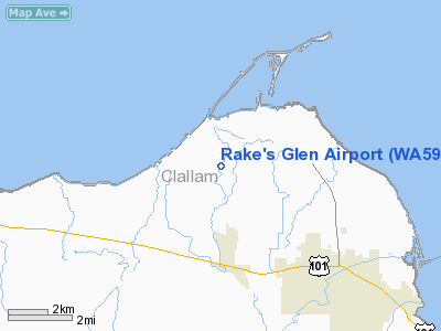
Location & QuickFacts
| FAA Information Effective: | 2008-09-25 |
| Airport Identifier: | WA59 |
| Airport Status: | Operational |
| Longitude/Latitude: | 123-10-34.6450W/48-07-29.3330N
-123.176290/48.124815 (Estimated) |
| Elevation: | 50 ft / 15.24 m (Estimated) |
| Land: | 50 acres |
| From nearest city: | 3 nautical miles NW of Sequim, WA |
| Location: | Clallam County, WA |
| Magnetic Variation: | 20E (1990) |
Owner & Manager
| Ownership: | Privately owned |
| Owner: | Rake's Glen Airstrip Assoc. |
| Address: | John Meyers, President, 122 Kitfox Ln
Sequim, WA 98382 |
| Phone number: | 360-683-6526 |
| Manager: | Ronald Shannon |
| Address: | 145 Kitfox Ln
Sequim, WA 98382 |
| Phone number: | 360-681-7160 |
Airport Operations and Facilities
| Airport Use: | Private |
| Wind indicator: | Yes |
| Segmented Circle: | No |
| Control Tower: | No |
| Sectional chart: | Seattle |
| Region: | ANM - Northwest Mountain |
| Boundary ARTCC: | ZSE - Seattle |
| Tie-in FSS: | SEA - Seattle |
| FSS on Airport: | No |
| FSS Toll Free: | 1-800-WX-BRIEF |
Runway Information
Runway 09/27
| Dimension: | 1600 x 24 ft / 487.7 x 7.3 m |
| Surface: | ASPH, |
| |
Runway 09 |
Runway 27 |
| Traffic Pattern: | Left | Right |
| Obstruction: | 60 ft trees, 700.0 ft from runway | |
|
Radio Navigation Aids
| ID |
Type |
Name |
Ch |
Freq |
Var |
Dist |
| CL | NDB | Elwha | | 515.00 | 22E | 19.9 nm |
| OPZ | NDB | Lopez Island | | 356.00 | 21E | 23.6 nm |
| FHR | NDB | Friday Harbor | | 284.00 | 20E | 24.9 nm |
| YJ | NDB | Victoria | | 200.00 | 21E | 32.5 nm |
| MB | NDB | Mill Bay | | 293.00 | 21E | 35.8 nm |
| BVS | NDB | Skagit/bay View | | 240.00 | 21E | 36.7 nm |
| PWT | NDB | Kitsap | | 206.00 | 20E | 41.6 nm |
| CAN | NDB | Carney | | 274.00 | 20E | 45.0 nm |
| AP | NDB | Active Pass | | 378.00 | 21E | 45.3 nm |
| NUW | TACAN | Whidbey Island | 085X | | 21E | 24.8 nm |
| CVV | VOR/DME | Penn Cove | 119X | 117.20 | 19E | 19.5 nm |
| PAE | VOR/DME | Paine | 043X | 110.60 | 20E | 38.2 nm |
| YYJ | VOR/DME | Victoria | 084X | 113.70 | 21E | 38.2 nm |
Remarks
- PRVDD ARPT TFC PATTERN IS TO THE NORTH & THAT THE COORDINATES OF THE LNDG AREA LOCATION ARE VERIFIED.
Images and information placed above are from
http://www.airport-data.com/airport/WA59/
We thank them for the data!
| General Info
|
| Country |
United States
|
| State |
WASHINGTON
|
| FAA ID |
WA59
|
| Latitude |
48-07-29.333N
|
| Longitude |
123-10-34.645W
|
| Elevation |
50 feet
|
| Near City |
SEQUIM
|
We don't guarantee the information is fresh and accurate. The data may
be wrong or outdated.
For more up-to-date information please refer to other sources.
|
|


