 |
|
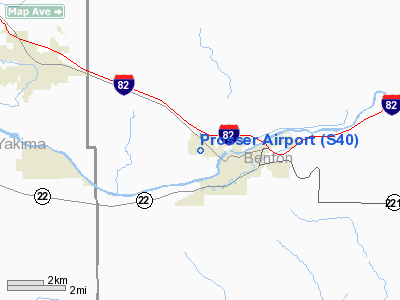
Location & QuickFacts
| FAA Information Effective: | 2008-09-25 |
| Airport Identifier: | S40 |
| Airport Status: | Operational |
| Longitude/Latitude: | 119-47-29.0000W/46-12-48.1000N
-119.791389/46.213361 (Estimated) |
| Elevation: | 697 ft / 212.45 m (Surveyed) |
| Land: | 120 acres |
| From nearest city: | 1 nautical miles NW of Prosser, WA |
| Location: | Benton County, WA |
| Magnetic Variation: | 19E (1985) |
Owner & Manager
| Ownership: | Publicly owned |
| Owner: | Port Of Benton |
| Address: | 3100 George Washington Hwy
Richland, WA 99352 |
| Phone number: | 509-375-3060 |
| Manager: | John Haakenson |
| Address: | 3100 George Washington Way
Richland, WA 99352 |
| Phone number: | 509-375-3060 |
Airport Operations and Facilities
| Airport Use: | Open to public |
| Wind indicator: | Yes |
| Segmented Circle: | Yes |
| Control Tower: | No |
| Lighting Schedule: | DUSK-DAWN
ACTVT MIRL RY 07/25 & REIL RYS 07 & 25 - CTAF. |
| Beacon Color: | Clear-Green (lighted land airport) |
| Landing fee charge: | No |
| Sectional chart: | Seattle |
| Region: | ANM - Northwest Mountain |
| Traffic Pattern Alt: | 800 ft |
| Boundary ARTCC: | ZSE - Seattle |
| Tie-in FSS: | SEA - Seattle |
| FSS on Airport: | No |
| FSS Toll Free: | 1-800-WX-BRIEF |
| NOTAMs Facility: | SEA (NOTAM-d service avaliable) |
| Federal Agreements: | NGY |
Airport Communications
| CTAF: | 122.800 |
| Unicom: | 122.800
UNICOM 122.8 0900-1700 ONLY. |
Airport Services
| Fuel available: | 100LL |
| Airframe Repair: | MAJOR |
| Power Plant Repair: | MAJOR |
| Bottled Oxygen: | NONE |
| Bulk Oxygen: | NONE |
Runway Information
Runway 07/25
| Dimension: | 3453 x 60 ft / 1052.5 x 18.3 m |
| Surface: | ASPH, Good Condition |
| Weight Limit: | Single wheel: 16000 lbs. |
| Edge Lights: | Medium |
| |
Runway 07 |
Runway 25 |
| Longitude: | 119-47-53.5039W | 119-47-04.3988W |
| Latitude: | 46-12-48.1633N | 46-12-48.0270N |
| Elevation: | 698.00 ft | 680.00 ft |
| Alignment: | 90 | 127 |
| Traffic Pattern: | Left | Right |
| Markings: | Basic, Good Condition | Basic, Good Condition |
| Crossing Height: | 20.00 ft | 26.00 ft |
| VASI: | 2-light PAPI on right side | 2-light PAPI on left side |
| Visual Glide Angle: | 3.00° | 4.00° |
| Runway End Identifier: | Yes | Yes |
| Obstruction: | 60 ft trees, 1861.0 ft from runway, 10 ft left of centerline, 27:1 slope to clear | 40 ft tree, 575.0 ft from runway, 200 ft right of centerline, 9:1 slope to clear |
|
Radio Navigation Aids
| ID |
Type |
Name |
Ch |
Freq |
Var |
Dist |
| PSC | VOR/DME | Pasco | 021X | 108.40 | 20E | 28.2 nm |
| YKM | VORTAC | Yakima | 107X | 116.00 | 21E | 34.5 nm |
| PDT | VORTAC | Pendleton | 094X | 114.70 | 20E | 47.2 nm |
Remarks
- TWYS MKD FOR NGT OPNS WITH RETRO-REFLECTIVE DEVICES.
- ESTABD PRIOR TO 15 MAY 1959.
Images and information placed above are from
http://www.airport-data.com/airport/S40/
We thank them for the data!
| General Info
|
| Country |
United States
|
| State |
WASHINGTON
|
| FAA ID |
S40
|
| Latitude |
46-12-44.478N
|
| Longitude |
119-47-34.124W
|
| Elevation |
694 feet
|
| Near City |
PROSSER
|
We don't guarantee the information is fresh and accurate. The data may
be wrong or outdated.
For more up-to-date information please refer to other sources.
|
|


