 |
|
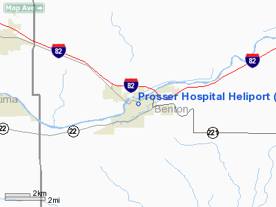
Prosser Hospital Heliport |
Location & QuickFacts
| FAA Information Effective: | 2008-09-25 |
| Airport Identifier: | 7WA6 |
| Airport Status: | Operational |
| Longitude/Latitude: | 119-45-49.1190W/46-12-29.4780N
-119.763644/46.208188 (Estimated) |
| Elevation: | 690 ft / 210.31 m (Estimated) |
| Land: | 0 acres |
| From nearest city: | 0 nautical miles N of Prosser, WA |
| Location: | Benton County, WA |
| Magnetic Variation: | 19E (1985) |
Owner & Manager
| Ownership: | Publicly owned |
| Owner: | Benton Cty.pub.hosp.-1 |
| Address: | 723 Memorial St.
Prosser, WA 99350 |
| Phone number: | 509-786-2222 |
| Manager: | John E Rohrer |
| Address: | 723 Memorial St.
Prosser, WA 99350 |
| Phone number: | 509-786-2222 |
Airport Operations and Facilities
| Airport Use: | Private
MEDICAL USE. |
| Wind indicator: | Yes |
| Segmented Circle: | No |
| Control Tower: | No |
| Landing fee charge: | No |
| Sectional chart: | Seattle |
| Region: | ANM - Northwest Mountain |
| Boundary ARTCC: | ZSE - Seattle |
| Tie-in FSS: | SEA - Seattle |
| FSS on Airport: | No |
| FSS Toll Free: | 1-800-WX-BRIEF |
Runway Information
Helipad H1
| Dimension: | 100 x 100 ft / 30.5 x 30.5 m |
| Surface: | ASPH, |
| |
Runway H1 |
Runway |
| Traffic Pattern: | Left | Left |
|
Radio Navigation Aids
| ID |
Type |
Name |
Ch |
Freq |
Var |
Dist |
| PSC | VOR/DME | Pasco | 021X | 108.40 | 20E | 27.1 nm |
| YKM | VORTAC | Yakima | 107X | 116.00 | 21E | 35.6 nm |
| PDT | VORTAC | Pendleton | 094X | 114.70 | 20E | 46.1 nm |
Images and information placed above are from
http://www.airport-data.com/airport/7WA6/
We thank them for the data!
| General Info
|
| Country |
United States
|
| State |
WASHINGTON
|
| FAA ID |
7WA6
|
| Latitude |
46-12-29.478N
|
| Longitude |
119-45-49.119W
|
| Elevation |
690 feet
|
| Near City |
PROSSER
|
We don't guarantee the information is fresh and accurate. The data may
be wrong or outdated.
For more up-to-date information please refer to other sources.
|
|


