|
|
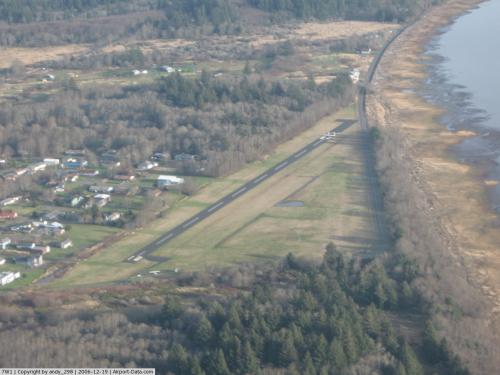 |
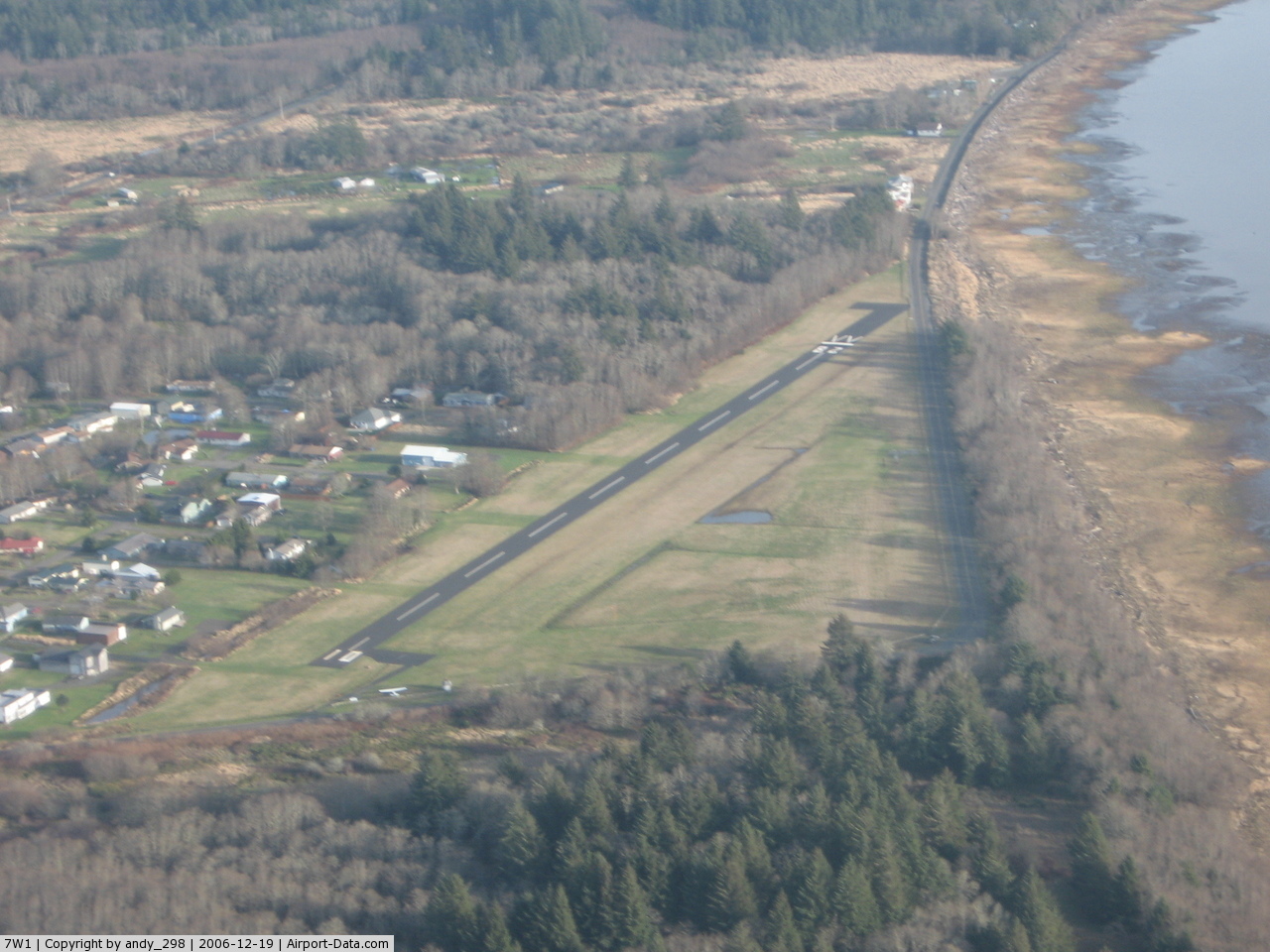
(Click on the photo to enlarge) |
Location & QuickFacts
| FAA Information Effective: | 2008-09-25 |
| Airport Identifier: | 7W1 |
| Airport Status: | Operational |
| Longitude/Latitude: | 124-00-13.8170W/46-18-53.6850N
-124.003838/46.314912 (Estimated) |
| Elevation: | 13 ft / 3.96 m (Estimated) |
| Land: | 34 acres |
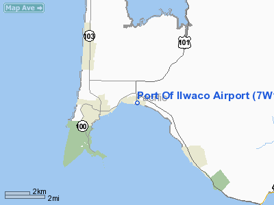
| From nearest city: | 2 nautical miles E of Ilwaco, WA |
| Location: | Pacific County, WA |
| Magnetic Variation: | 20E (1985) |
Owner & Manager
| Ownership: | Publicly owned |
| Owner: | Port Of Ilwaco |
| Address: | 165 Howerton Avenue, Po Box 307
Ilwaco, WA 98624 |
| Phone number: | 360-642-3143 |
| Manager: | Jim Neva |
| Address: | Port Of Ilwaco 165 Howerton Avenue, Po Box 307
Ilwaco, WA 98624 |
| Phone number: | 360-642-3143 |
Airport Operations and Facilities
| Airport Use: | Open to public |
| Wind indicator: | Yes |
| Segmented Circle: | No |
| Control Tower: | No |
| Lighting Schedule: | DUSK-DAWN
ACTVT MIRL RY 10/28 - CTAF. |
| Beacon Color: | Clear-Green (lighted land airport) |
| Landing fee charge: | No |
| Sectional chart: | Seattle |
| Region: | ANM - Northwest Mountain |
| Boundary ARTCC: | ZSE - Seattle |
| Tie-in FSS: | SEA - Seattle |
| FSS on Airport: | No |
| FSS Toll Free: | 1-800-WX-BRIEF |
| NOTAMs Facility: | SEA (NOTAM-d service avaliable) |
Airport Communications
Airport Services
| Airframe Repair: | NONE |
| Power Plant Repair: | NONE |
| Bottled Oxygen: | NONE |
| Bulk Oxygen: | NONE |
Runway Information
Runway 10/28
| Dimension: | 2080 x 50 ft / 634.0 x 15.2 m |
| Surface: | ASPH, Good Condition |
| Weight Limit: | Single wheel: 5000 lbs.
FULL STRENGTH PAVEMENT CENTER 30' ONLY. |
| Edge Lights: | Medium |
| |
Runway 10 |
Runway 28 |
| Longitude: | 124-00-26.6790W | 124-00-00.9560W |
| Latitude: | 46-18-58.7800N | 46-18-48.5900N |
| Alignment: | 120 | 127 |
| Traffic Pattern: | Left | Left |
| Markings: | Basic, Good Condition | Basic, Good Condition |
| Displaced threshold: | 0.00 ft | 300.00 ft |
| VASI: | | 2-light PAPI on left side |
| Visual Glide Angle: | 0.00° | 4.00° |
| Obstruction: | 15 ft road, 212.0 ft from runway, 38 ft right of centerline
RWY 10 ROAD 0-200 FT FROM END, 75 FT R; +4 FT SIGN AT 70 FT, 75 FT R. | 15 ft road, 300.0 ft from runway, 6:1 slope to clear
RWY 28 APRCH SLOPE 6:1 AT DSPLCD THLD |
|
Radio Navigation Aids
| ID |
Type |
Name |
Ch |
Freq |
Var |
Dist |
| AST | FAN MARKER | Fort Stevens | | | 22E | 6.6 nm |
| PEN | NDB | Karpen | | 201.00 | 20E | 20.3 nm |
| LSO | NDB | Kelso | | 256.00 | 21E | 46.4 nm |
| AST | VOR/DME | Astoria | 087X | 114.00 | 19E | 10.5 nm |
| HQM | VORTAC | Hoquiam | 124X | 117.70 | 19E | 38.5 nm |
Remarks
- ESTABD PRIOR TO MAY 1959.
Images and information placed above are from
http://www.airport-data.com/airport/7W1/
We thank them for the data!
| General Info
|
| Country |
United States
|
| State |
WASHINGTON
|
| FAA ID |
7W1
|
| Latitude |
46-18-59.362N
|
| Longitude |
124-00-04.552W
|
| Elevation |
8 feet
|
| Near City |
ILWACO
|
We don't guarantee the information is fresh and accurate. The data may
be wrong or outdated.
For more up-to-date information please refer to other sources.
|
|