 |
|
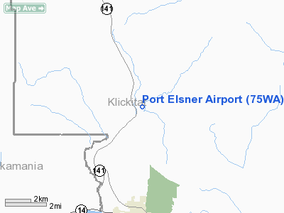
Location & QuickFacts
| FAA Information Effective: | 2008-09-25 |
| Airport Identifier: | 75WA |
| Airport Status: | Operational |
| Longitude/Latitude: | 121-28-46.2670W/45-48-07.4320N
-121.479519/45.802064 (Estimated) |
| Elevation: | 610 ft / 185.93 m (Estimated) |
| Land: | 35 acres |
| From nearest city: | 4 nautical miles N of White Salmon, WA |
| Location: | Klickitat County, WA |
| Magnetic Variation: | 19E (1985) |
Owner & Manager
| Ownership: | Privately owned |
| Owner: | Bernard M. Elsner |
| Address: | 83 Oakridge Rd
White Salmon, WA 98672 |
| Phone number: | 509-493-2161 |
| Manager: | Bernard M. Elsner |
| Address: | 83 Oakridge Rd
White Salmon, WA 98672 |
| Phone number: | 509-493-2161 |
Airport Operations and Facilities
| Airport Use: | Private |
| Wind indicator: | Yes |
| Segmented Circle: | No |
| Control Tower: | No |
| Landing fee charge: | No |
| Sectional chart: | Seattle |
| Region: | ANM - Northwest Mountain |
| Boundary ARTCC: | ZSE - Seattle |
| Tie-in FSS: | SEA - Seattle |
| FSS on Airport: | No |
| FSS Toll Free: | 1-800-WX-BRIEF |
Runway Information
Runway 17/35
| Dimension: | 1600 x 40 ft / 487.7 x 12.2 m |
| Surface: | TURF, |
| |
Runway 17 |
Runway 35 |
| Traffic Pattern: | Left | Left |
| Obstruction: | 200 ft tree, 100.0 ft from runway | |
|
Radio Navigation Aids
| ID |
Type |
Name |
Ch |
Freq |
Var |
Dist |
| LBH | NDB | Laker | | 332.00 | 20E | 44.2 nm |
| CBU | TACAN | Columbia | 029X | | 20E | 49.2 nm |
| LTJ | VOR/DME | Klickitat | 070X | 112.30 | 21E | 16.7 nm |
| PDX | VOR/DME | Portland | 055X | 111.80 | 20E | 48.9 nm |
| BTG | VORTAC | Battle Ground | 113X | 116.60 | 21E | 46.7 nm |
| PDX | VOT | Portland Intl | | 111.00 | | 48.6 nm |
Remarks
- LAND TO THE NORTH UNLESS THERE IS A STRONG SOUTH WIND TAKEOFF TO THE SOUTH.
- RWY 35 PRIMARILY FOR LNDG & RWY 17 PRIMARILY FOR TOF UNLESS WINDS ARE PROHIBITIVE.
- NOTE: NIGHT OPERATIONS PROHIBITED.
- FILED FOR RECORD PURPOSES.
Images and information placed above are from
http://www.airport-data.com/airport/75WA/
We thank them for the data!
| General Info
|
| Country |
United States
|
| State |
WASHINGTON
|
| FAA ID |
75WA
|
| Latitude |
45-48-07.432N
|
| Longitude |
121-28-46.267W
|
| Elevation |
610 feet
|
| Near City |
WHITE SALMON
|
We don't guarantee the information is fresh and accurate. The data may
be wrong or outdated.
For more up-to-date information please refer to other sources.
|
|


