 |
|
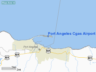
Port Angeles Cgas Airport |
Location & QuickFacts
| FAA Information Effective: | 2008-09-25 |
| Airport Identifier: | NOW |
| Airport Status: | Operational |
| Longitude/Latitude: | 123-24-50.6680W/48-08-28.3260N
-123.414074/48.141202 (Estimated) |
| Elevation: | 13 ft / 3.96 m (Surveyed) |
| Land: | 0 acres |
| From nearest city: | 2 nautical miles N of Port Angeles, WA |
| Location: | Clallam County, WA |
| Magnetic Variation: | 22E (1980) |
Owner & Manager
| Ownership: | Navy owned |
| Owner: | Uscg |
| Address: | Port Angeles Cgas
Port Angeles, WA 98362 |
| Manager: | Lcdr Fergeson Opn Off |
| Address: | Port Angeles Cgas
Port Angeles, WA 98362 |
| Phone number: | 206-457-4401 |
Airport Operations and Facilities
| Airport Use: | Private |
| Wind indicator: | Yes |
| Segmented Circle: | No |
| Control Tower: | No |
| Lighting Schedule: | DUSK-DAWN |
| Beacon Color: | Split-Clear-Green (lighted military airport) |
| Sectional chart: | Seattle |
| Region: | ANM - Northwest Mountain |
| Boundary ARTCC: | ZSE - Seattle |
| Tie-in FSS: | SEA - Seattle |
| FSS on Airport: | No |
| FSS Toll Free: | 1-800-WX-BRIEF |
| NOTAMs Facility: | SEA (NOTAM-d service avaliable) |
Airport Communications
| CTAF: | 123.000 |
| Unicom: | 123.000 |
Runway Information
Runway 07/25
| Dimension: | 4500 x 150 ft / 1371.6 x 45.7 m |
| Surface: | ASPH, |
| Edge Lights: | Non-standard lighting system
NSTD HIRL NO RY EDGE LGTS NORTH SIDE;FIRST 1500 FT ON RY 07. |
| |
Runway 07 |
Runway 25 |
| Longitude: | 123-25-23.3500W | 123-24-17.1190W |
| Latitude: | 48-08-30.0260N | 48-08-27.2810N |
| Elevation: | 9.00 ft | 8.00 ft |
| Alignment: | 93 | 127 |
| Traffic Pattern: | Left | Left |
|
Helipad H1
| Dimension: | 100 x 100 ft / 30.5 x 30.5 m |
| Surface: | ASPH, |
| Edge Lights: | Low
NSTD HIRL NO RY EDGE LGTS NORTH SIDE;FIRST 1500 FT ON RY 07. |
| |
Runway H1 |
Runway |
| Traffic Pattern: | Left | Left |
|
Radio Navigation Aids
| ID |
Type |
Name |
Ch |
Freq |
Var |
Dist |
| CL | NDB | Elwha | | 515.00 | 22E | 10.3 nm |
| FHR | NDB | Friday Harbor | | 284.00 | 20E | 27.8 nm |
| OPZ | NDB | Lopez Island | | 356.00 | 21E | 28.3 nm |
| YJ | NDB | Victoria | | 200.00 | 21E | 30.2 nm |
| MB | NDB | Mill Bay | | 293.00 | 21E | 32.2 nm |
| AP | NDB | Active Pass | | 378.00 | 21E | 44.3 nm |
| BVS | NDB | Skagit/bay View | | 240.00 | 21E | 44.4 nm |
| PWT | NDB | Kitsap | | 206.00 | 20E | 47.2 nm |
| CAN | NDB | Carney | | 274.00 | 20E | 49.7 nm |
| NUW | TACAN | Whidbey Island | 085X | | 21E | 32.7 nm |
| CVV | VOR/DME | Penn Cove | 119X | 117.20 | 19E | 28.3 nm |
| YYJ | VOR/DME | Victoria | 084X | 113.70 | 21E | 35.3 nm |
| PAE | VOR/DME | Paine | 043X | 110.60 | 20E | 47.6 nm |
| TOU | VORTAC | Tatoosh | 059X | 112.20 | 22E | 49.5 nm |
Remarks
- NO ATCT/TRANS QTRS NOT AVBL.
- BIRDS ON RY SPRING THRU SUMMER.
- CLSD TO ALL NON-CG FIXED WING ACFT WITHOUT 24 HR PPR C360-417-5840.
Images and information placed above are from
http://www.airport-data.com/airport/NOW/
We thank them for the data!
| General Info
|
| Country |
United States
|
| State |
WASHINGTON
|
| FAA ID |
NOW
|
| Latitude |
48-08-28.326N
|
| Longitude |
123-24-50.668W
|
| Elevation |
13 feet
|
| Near City |
PORT ANGELES
|
We don't guarantee the information is fresh and accurate. The data may
be wrong or outdated.
For more up-to-date information please refer to other sources.
|
|


