 |
|
Location & QuickFacts
| FAA Information Effective: | 2008-09-25 |
| Airport Identifier: | 9WA4 |
| Airport Status: | Operational |
| Longitude/Latitude: | 120-57-20.0000W/45-48-10.0000N
-120.955556/45.802778 (Estimated) |
| Elevation: | 1610 ft / 490.73 m (Estimated) |
| Land: | 80 acres |
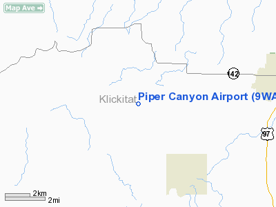
| From nearest city: | 5 nautical miles SW of Goldendale, WA |
| Location: | Klickitat County, WA |
| Magnetic Variation: | 18E (2000) |
Owner & Manager
| Ownership: | Privately owned |
| Owner: | Dwayne & Ellen Hansen |
| Address: | 322 N. Hayden Bay Drive
Portland, OR 97217 |
| Phone number: | 503-286-9872 |
| Manager: | Dwayne Hansen |
| Address: | 322 N. Hayden Bay Drive
Portland, OR 97217 |
| Phone number: | 503-286-9872 |
Airport Operations and Facilities
| Airport Use: | Private |
| Segmented Circle: | No |
| Control Tower: | No |
| Sectional chart: | Seattle |
| Region: | ANM - Northwest Mountain |
| Boundary ARTCC: | ZSE - Seattle |
| Tie-in FSS: | SEA - Seattle |
| FSS Toll Free: | 1-800-WX-BRIEF |
Runway Information
Runway 07/25
| Dimension: | 1400 x 30 ft / 426.7 x 9.1 m |
| Surface: | GRVL, Good Condition |
| |
Runway 07 |
Runway 25 |
| Traffic Pattern: | Left | Left |
| Obstruction: | 50 ft trees, 100.0 ft from runway | 50 ft trees, 85.0 ft from runway |
|
Radio Navigation Aids
| ID |
Type |
Name |
Ch |
Freq |
Var |
Dist |
| LTJ | VOR/DME | Klickitat | 070X | 112.30 | 21E | 8.1 nm |
Images and information placed above are from
http://www.airport-data.com/airport/9WA4/
We thank them for the data!
| General Info
|
| Country |
United States
|
| State |
WASHINGTON
|
| FAA ID |
9WA4
|
| Latitude |
45-48-10.000N
|
| Longitude |
120-57-20.000W
|
| Elevation |
1610 feet
|
| Near City |
GOLDENDALE
|
We don't guarantee the information is fresh and accurate. The data may
be wrong or outdated.
For more up-to-date information please refer to other sources.
|
|


