 |
|
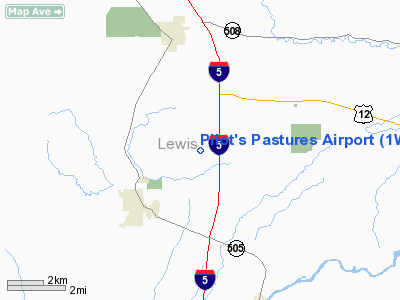
Location & QuickFacts
| FAA Information Effective: | 2008-09-25 |
| Airport Identifier: | 1WA2 |
| Airport Status: | Operational |
| Longitude/Latitude: | 122-53-24.3000W/46-31-09.3000N
-122.890083/46.519250 (Estimated) |
| Elevation: | 450 ft / 137.16 m (Estimated) |
| Land: | 51 acres |
| From nearest city: | 3 nautical miles NE of Winlock, WA |
| Location: | Lewis County, WA |
| Magnetic Variation: | 19E (1995) |
Owner & Manager
| Ownership: | Privately owned |
| Owner: | Pilot's Pastures Home Owners |
| Address: | 220 Sargent Road
Winlock, WA 98596 |
| Phone number: | 206-785-3116 |
| Manager: | Steve & Starr Craig |
| Address: | 220 Sargent Road
Winlock, WA 98596 |
| Phone number: | 206-785-3116 |
Airport Operations and Facilities
| Airport Use: | Private |
| Wind indicator: | Yes |
| Segmented Circle: | No |
| Control Tower: | No |
| Sectional chart: | Seattle |
| Region: | ANM - Northwest Mountain |
| Boundary ARTCC: | ZSE - Seattle |
| Tie-in FSS: | SEA - Seattle |
| FSS on Airport: | No |
| FSS Toll Free: | 1-800-WX-BRIEF |
Runway Information
Runway 08/26
| Dimension: | 2200 x 85 ft / 670.6 x 25.9 m |
| Surface: | TURF, |
| |
Runway 08 |
Runway 26 |
| Traffic Pattern: | Left | Right |
| Obstruction: | 50 ft trees, 100.0 ft from runway | 300 ft pline, 400.0 ft from runway |
|
Runway 16/34
| Dimension: | 1800 x 85 ft / 548.6 x 25.9 m |
| Surface: | TURF, |
| |
Runway 16 |
Runway 34 |
| Traffic Pattern: | Right | Left |
| Obstruction: | | 100 ft trees, 500.0 ft from runway |
|
Radio Navigation Aids
| ID |
Type |
Name |
Ch |
Freq |
Var |
Dist |
| AST | FAN MARKER | Fort Stevens | | | 22E | 48.4 nm |
| TDO | NDB | Toledo | | 219.00 | 20E | 4.0 nm |
| LSO | NDB | Kelso | | 256.00 | 21E | 21.9 nm |
| LAC | NDB | Lacomas | | 328.00 | 18E | 32.4 nm |
| PEN | NDB | Karpen | | 201.00 | 20E | 36.9 nm |
| GR | NDB | Graye | | 216.00 | 18E | 39.7 nm |
| MNC | NDB | Mason County | | 348.00 | 19E | 44.5 nm |
| AST | VOR/DME | Astoria | 087X | 114.00 | 19E | 46.4 nm |
| OLM | VORTAC | Olympia | 081X | 113.40 | 19E | 27.2 nm |
| TCM | VORTAC | Mcchord | 033X | 109.60 | 22E | 41.4 nm |
| BTG | VORTAC | Battle Ground | 113X | 116.60 | 21E | 48.0 nm |
Remarks
- RYS 08/26 & 16/34 POSSIBLE SOFT TURF IN WET SEASON.
Images and information placed above are from
http://www.airport-data.com/airport/1WA2/
We thank them for the data!
| General Info
|
| Country |
United States
|
| State |
WASHINGTON
|
| FAA ID |
1WA2
|
| Latitude |
46-31-09.300N
|
| Longitude |
122-53-24.300W
|
| Elevation |
450 feet
|
| Near City |
WINLOCK
|
We don't guarantee the information is fresh and accurate. The data may
be wrong or outdated.
For more up-to-date information please refer to other sources.
|
|


