 |
|
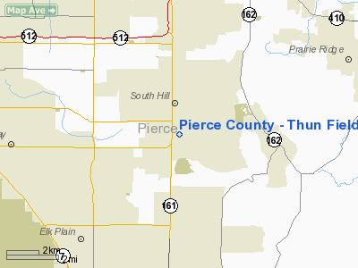
Pierce County - Thun Field Airport |
Location & QuickFacts
| FAA Information Effective: | 2008-09-25 |
| Airport Identifier: | PLU |
| Airport Status: | Operational |
| Longitude/Latitude: | 122-17-13.9000W/47-06-14.1000N
-122.287194/47.103917 (Estimated) |
| Elevation: | 538 ft / 163.98 m (Surveyed) |
| Land: | 200 acres |
| From nearest city: | 5 nautical miles S of Puyallup, WA |
| Location: | Pierce County, WA |
| Magnetic Variation: | 20E (1985) |
Owner & Manager
| Ownership: | Publicly owned |
| Owner: | Pierce County |
| Address: | 2702 S. 42nd Street, Suite 201
Tacoma, WA 98409 |
| Phone number: | 253-798-7109
AIRPORT PHYSICAL PHONE NO: (253) - 841-3779 |
| Manager: | Michael Esher
BRUCE THUN IS THE AIRPORT OPERATIONS MANAGER. |
| Address: | 2702 S. 42nd Street, Suite 201, Room 150
Tacoma, WA 98409 |
| Phone number: | 253-798-7109 |
Airport Operations and Facilities
| Airport Use: | Open to public |
| Wind indicator: | Yes |
| Segmented Circle: | Yes |
| Control Tower: | No |
| Lighting Schedule: | DUSK-DAWN |
| Beacon Color: | Clear-Green (lighted land airport) |
| Landing fee charge: | No |
| Sectional chart: | Seattle |
| Region: | ANM - Northwest Mountain |
| Traffic Pattern Alt: | 1000 ft |
| Boundary ARTCC: | ZSE - Seattle |
| Tie-in FSS: | SEA - Seattle |
| FSS on Airport: | No |
| FSS Toll Free: | 1-800-WX-BRIEF |
| NOTAMs Facility: | PLU (NOTAM-d service avaliable) |
| Federal Agreements: | NGY |
Airport Communications
| CTAF: | 122.700 |
| Unicom: | 122.700 |
Airport Services
| Fuel available: | 100LL
FUEL AVBL 24 HOURS WITH CREDIT CARD. |
| Airframe Repair: | MAJOR |
| Power Plant Repair: | MAJOR |
| Bottled Oxygen: | LOW |
| Bulk Oxygen: | NONE |
Runway Information
Runway 16/34
| Dimension: | 3650 x 60 ft / 1112.5 x 18.3 m |
| Surface: | ASPH, Good Condition |
| Edge Lights: | Medium |
| |
Runway 16 |
Runway 34 |
| Longitude: | 122-17-13.6393W | 122-17-14.2036W |
| Latitude: | 47-06-32.1228N | 47-05-56.1014N |
| Elevation: | 538.00 ft | 536.00 ft |
| Alignment: | 127 | 0 |
| Traffic Pattern: | Left | Left |
| Markings: | Basic, Good Condition | Basic, Good Condition |
| Crossing Height: | 53.00 ft | 53.00 ft |
| VASI: | 4-light PAPI on left side | 4-light PAPI on right side |
| Visual Glide Angle: | 4.00° | 4.00° |
| Runway End Identifier: | Yes | Yes |
| Obstruction: | 86 ft trees, 2784.0 ft from runway, 30:1 slope to clear | 13 ft road, 242.0 ft from runway, 3:1 slope to clear |
|
Radio Navigation Aids
| ID |
Type |
Name |
Ch |
Freq |
Var |
Dist |
| LAC | NDB | Lacomas | | 328.00 | 18E | 12.4 nm |
| GR | NDB | Graye | | 216.00 | 18E | 13.3 nm |
| ODD | NDB | Dondo | | 224.00 | 19E | 15.7 nm |
| RNT | NDB | Renton | | 353.00 | 20E | 23.7 nm |
| CAN | NDB | Carney | | 274.00 | 20E | 29.1 nm |
| PWT | NDB | Kitsap | | 206.00 | 20E | 30.2 nm |
| MNC | NDB | Mason County | | 348.00 | 19E | 33.8 nm |
| TDO | NDB | Toledo | | 219.00 | 20E | 43.6 nm |
| PAE | VOR/DME | Paine | 043X | 110.60 | 20E | 49.0 nm |
| TCM | VORTAC | Mcchord | 033X | 109.60 | 22E | 8.1 nm |
| SEA | VORTAC | Seattle | 115X | 116.80 | 19E | 19.9 nm |
| OLM | VORTAC | Olympia | 081X | 113.40 | 19E | 26.4 nm |
| SEA | VOT | Seattle-tacoma | | 117.50 | | 20.4 nm |
| BFI | VOT | Boeing Field | | 108.60 | | 25.5 nm |
Remarks
- ULTRALIGHTS PROHIBITED.
- NOISE SENSITIVE ALL QUADRANTS.
- ESTABD PRIOR TO 15 MAY 1959.
Images and information placed above are from
http://www.airport-data.com/airport/PLU/
We thank them for the data!
| General Info
|
| Country |
United States
|
| State |
CALIFORNIA
|
| FAA ID |
CL94
|
| Latitude |
39-56-25.610N
|
| Longitude |
120-57-33.835W
|
| Elevation |
3425 feet
|
| Near City |
QUINCY
|
We don't guarantee the information is fresh and accurate. The data may
be wrong or outdated.
For more up-to-date information please refer to other sources.
|
|


