 |
|
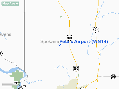
Location & QuickFacts
| FAA Information Effective: | 2008-09-25 |
| Airport Identifier: | WN14 |
| Airport Status: | Operational |
| Longitude/Latitude: | 117-26-48.7950W/47-50-29.6100N
-117.446888/47.841558 (Estimated) |
| Elevation: | 2160 ft / 658.37 m (Estimated) |
| Land: | 10 acres |
| From nearest city: | 0 nautical miles N of Deer Park, WA |
| Location: | Spokane County, WA |
| Magnetic Variation: | 19E (1985) |
Owner & Manager
| Ownership: | Privately owned |
| Owner: | Peter E. Gifford |
| Address: | N20211 Austin Road
Colbert, WA 99005 |
| Phone number: | 509-466-9028 |
| Manager: | Peter E. Gifford |
| Address: | N20211 Austin Rd
Colbert, WA 99005 |
| Phone number: | 509-466-9028 |
Airport Operations and Facilities
| Airport Use: | Private |
| Segmented Circle: | No |
| Control Tower: | No |
| Sectional chart: | Seattle |
| Region: | ANM - Northwest Mountain |
| Boundary ARTCC: | ZSE - Seattle |
| Tie-in FSS: | SEA - Seattle |
| FSS Toll Free: | 1-800-WX-BRIEF |
Runway Information
Runway 07/25
| Dimension: | 1330 x 75 ft / 405.4 x 22.9 m |
| Surface: | TURF, |
| |
Runway 07 |
Runway 25 |
| Traffic Pattern: | Left | Left |
|
Radio Navigation Aids
| ID |
Type |
Name |
Ch |
Freq |
Var |
Dist |
| DPY | NDB | Deer Park | | 216.00 | 19E | 7.6 nm |
| SFF | NDB | Felts | | 365.00 | 19E | 10.8 nm |
| SZT | NDB | Sandpoe | | 264.00 | 20E | 44.6 nm |
| SKA | TACAN | Fairchild | 051X | | 19E | 16.4 nm |
| COE | VOR/DME | Coeur D'alene | 025X | 108.80 | 19E | 25.6 nm |
| GEG | VORTAC | Spokane | 102X | 115.50 | 21E | 18.2 nm |
| SFF | VOT | Spokane/felts Field | | 114.00 | | 11.0 nm |
| GEG | VOT | Spokane Intl | | 109.60 | | 13.7 nm |
Remarks
- ONE WAY STRIP. TAKEOFFS WEST; LANDINGS EAST
- PROVIDED PVT USE ONLY; ARPT IS UNCHARTED; FOR VFR DAYTIME OPERATIONS.
Images and information placed above are from
http://www.airport-data.com/airport/WN14/
We thank them for the data!
| General Info
|
| Country |
United States
|
| State |
WASHINGTON
|
| FAA ID |
WN14
|
| Latitude |
47-50-29.610N
|
| Longitude |
117-26-48.795W
|
| Elevation |
2160 feet
|
| Near City |
DEER PARK
|
We don't guarantee the information is fresh and accurate. The data may
be wrong or outdated.
For more up-to-date information please refer to other sources.
|
|


