 |
|
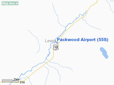
Location & QuickFacts
| FAA Information Effective: | 2008-09-25 |
| Airport Identifier: | 55S |
| Airport Status: | Operational |
| Longitude/Latitude: | 121-40-40.4390W/46-36-14.9840N
-121.677900/46.604162 (Estimated) |
| Elevation: | 1057 ft / 322.17 m (Estimated) |
| Land: | 13 acres |
| From nearest city: | 0 nautical miles W of Packwood, WA |
| Location: | Lewis County, WA |
| Magnetic Variation: | 20E (1985) |
Owner & Manager
| Ownership: | Publicly owned |
| Owner: | Lewis County |
| Address: | 2025 Ne Kresky Ave
Chehalis, WA 98532 |
| Phone number: | 360-740-2606 |
| Manager: | Larry Mason |
| Address: | 826 Cinebar Road
Cinebar, WA 98533-9732 |
| Phone number: | 360-269-6727 |
Airport Operations and Facilities
| Airport Use: | Open to public |
| Wind indicator: | Yes |
| Segmented Circle: | No |
| Control Tower: | No |
| Lighting Schedule: | DUSK-DAWN
ACTVT MIRL RY 01/19 - CTAF. |
| Beacon Color: | Clear-Green (lighted land airport) |
| Landing fee charge: | No |
| Sectional chart: | Seattle |
| Region: | ANM - Northwest Mountain |
| Boundary ARTCC: | ZSE - Seattle |
| Tie-in FSS: | SEA - Seattle |
| FSS on Airport: | No |
| FSS Toll Free: | 1-800-WX-BRIEF |
| NOTAMs Facility: | SEA (NOTAM-d service avaliable) |
| Federal Agreements: | N1 |
Airport Communications
Airport Services
| Airframe Repair: | NONE |
| Power Plant Repair: | NONE |
| Bottled Oxygen: | NONE |
| Bulk Oxygen: | NONE |
Runway Information
Runway 01/19
| Dimension: | 2356 x 38 ft / 718.1 x 11.6 m |
| Surface: | ASPH, Good Condition |
| Edge Lights: | Medium |
| |
Runway 01 |
Runway 19 |
| Longitude: | 121-40-48.5600W | 121-40-32.3180W |
| Latitude: | 46-36-04.7910N | 46-36-25.1760N |
| Traffic Pattern: | Left | Left |
| Obstruction: | 5 ft fence, 200.0 ft from runway
RWY 01 +15' BRUSH AT 125' & +5' FENCE AT 140' AND -5' DITCH AT 155' FROM THR. | 33 ft trees, 200.0 ft from runway, 125 ft right of centerline
+4' FENCE AT 120', 0' PAVED ROAD AT 130' AND 33' TREES 113'-200' FR THR 100'R. |
|
Radio Navigation Aids
| ID |
Type |
Name |
Ch |
Freq |
Var |
Dist |
| LAC | NDB | Lacomas | | 328.00 | 18E | 43.5 nm |
| TDO | NDB | Toledo | | 219.00 | 20E | 47.7 nm |
| TCM | VORTAC | Mcchord | 033X | 109.60 | 22E | 46.3 nm |
Remarks
- TREES AND BLDGS IN TRANSITIONAL SURFACES.
- TREES & FENCES IN PRIM SFC.
- EXISTED PRIOR TO 1959.
Images and information placed above are from
http://www.airport-data.com/airport/55S/
We thank them for the data!
| General Info
|
| Country |
United States
|
| State |
WASHINGTON
|
| FAA ID |
55S
|
| Latitude |
46-36-14.403N
|
| Longitude |
121-40-40.319W
|
| Elevation |
1053 feet
|
| Near City |
PACKWOOD
|
We don't guarantee the information is fresh and accurate. The data may
be wrong or outdated.
For more up-to-date information please refer to other sources.
|
|


