 |
|
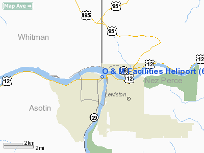
O & M Facilities Heliport |
Location & QuickFacts
| FAA Information Effective: | 2008-09-25 |
| Airport Identifier: | 69WA |
| Airport Status: | Operational |
| Longitude/Latitude: | 117-02-20.8690W/46-25-20.3810N
-117.039130/46.422328 (Estimated) |
| Elevation: | 744 ft / 226.77 m (Estimated) |
| Land: | 0 acres |
| From nearest city: | 0 nautical miles SW of Clarkston, WA |
| Location: | Asotin County, WA |
| Magnetic Variation: | 19E (1985) |
Owner & Manager
| Ownership: | Publicly owned |
| Owner: | Corps Of Engineers |
| Address: | 100 Fair St
Clarkston, WA 99403 |
| Phone number: | 509-758-9676 |
| Manager: | Resource Manager |
| Address: | 100 Fair St
Clarkston, WA 99403 |
| Phone number: | 509-758-9676 |
Airport Operations and Facilities
| Airport Use: | Private |
| Wind indicator: | No |
| Segmented Circle: | No |
| Control Tower: | No |
| Landing fee charge: | No |
| Sectional chart: | Seattle |
| Region: | ANM - Northwest Mountain |
| Boundary ARTCC: | ZSE - Seattle |
| Tie-in FSS: | SEA - Seattle |
| FSS on Airport: | No |
| FSS Toll Free: | 1-800-WX-BRIEF |
Runway Information
Helipad H1
| Dimension: | 96 x 62 ft / 29.3 x 18.9 m |
| Surface: | ASPH-CONC, |
| |
Runway H1 |
Runway |
| Traffic Pattern: | Left | Left |
|
Radio Navigation Aids
| ID |
Type |
Name |
Ch |
Freq |
Var |
Dist |
| GVV | NDB | Grain | | 280.00 | 18E | 44.7 nm |
| MQG | VOR/DME | Nez Perce | 019X | 108.20 | 20E | 7.4 nm |
| PUW | VOR/DME | Pullman | 027X | 109.00 | 20E | 17.0 nm |
Images and information placed above are from
http://www.airport-data.com/airport/69WA/
We thank them for the data!
| General Info
|
| Country |
United States
|
| State |
WASHINGTON
|
| FAA ID |
69WA
|
| Latitude |
46-25-20.381N
|
| Longitude |
117-02-20.869W
|
| Elevation |
744 feet
|
| Near City |
CLARKSTON
|
We don't guarantee the information is fresh and accurate. The data may
be wrong or outdated.
For more up-to-date information please refer to other sources.
|
|


