 |
|
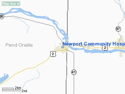
Newport Community Hosp Heliport |
Location & QuickFacts
| FAA Information Effective: | 2008-09-25 |
| Airport Identifier: | WN32 |
| Airport Status: | Operational |
| Longitude/Latitude: | 117-02-57.7300W/48-10-54.6590N
-117.049369/48.181850 (Estimated) |
| Elevation: | 2150 ft / 655.32 m (Estimated) |
| Land: | 0 acres |
| From nearest city: | 0 nautical miles N of Newport, WA |
| Location: | Pend Oreille County, WA |
| Magnetic Variation: | 20E (1985) |
Owner & Manager
| Ownership: | Privately owned |
| Owner: | Newport Community Hospital |
| Address: | Scott & Pines St, Box 669
Newport, WA 99156 |
| Phone number: | 509-447-2441 |
| Manager: | Hospital Administrator |
| Address: | Po Box 669
Newport, WA 99156 |
| Phone number: | 509-447-2441 |
Airport Operations and Facilities
| Airport Use: | Private
MEDICAL USE. |
| Wind indicator: | Yes |
| Segmented Circle: | No |
| Control Tower: | No |
| Lighting Schedule: | DUSK-DAWN |
| Landing fee charge: | No |
| Sectional chart: | Seattle |
| Region: | ANM - Northwest Mountain |
| Boundary ARTCC: | ZSE - Seattle |
| Tie-in FSS: | SEA - Seattle |
| FSS on Airport: | No |
| FSS Toll Free: | 1-800-WX-BRIEF |
Runway Information
Helipad H1
| Dimension: | 100 x 100 ft / 30.5 x 30.5 m |
| Surface: | ASPH, Good Condition |
| |
Runway H1 |
Runway |
| Traffic Pattern: | Left | Left |
|
Radio Navigation Aids
| ID |
Type |
Name |
Ch |
Freq |
Var |
Dist |
| DPY | NDB | Deer Park | | 216.00 | 19E | 19.9 nm |
| SZT | NDB | Sandpoe | | 264.00 | 20E | 20.5 nm |
| SFF | NDB | Felts | | 365.00 | 19E | 31.6 nm |
| ION | NDB | Ione | | 379.00 | 21E | 34.9 nm |
| SKA | TACAN | Fairchild | 051X | | 19E | 42.3 nm |
| COE | VOR/DME | Coeur D'alene | 025X | 108.80 | 19E | 26.2 nm |
| GEG | VORTAC | Spokane | 102X | 115.50 | 21E | 43.8 nm |
| SFF | VOT | Spokane/felts Field | | 114.00 | | 32.0 nm |
| GEG | VOT | Spokane Intl | | 109.60 | | 39.0 nm |
Remarks
- FOR EMERGENCY USE ONLY, PATIENT TRANSPORT.
Images and information placed above are from
http://www.airport-data.com/airport/WN32/
We thank them for the data!
| General Info
|
| Country |
United States
|
| State |
WASHINGTON
|
| FAA ID |
WN32
|
| Latitude |
48-10-54.659N
|
| Longitude |
117-02-57.730W
|
| Elevation |
2150 feet
|
| Near City |
NEWPORT
|
We don't guarantee the information is fresh and accurate. The data may
be wrong or outdated.
For more up-to-date information please refer to other sources.
|
|


