 |
|
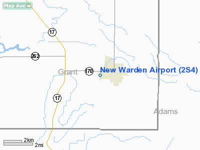
Location & QuickFacts
| FAA Information Effective: | 2008-09-25 |
| Airport Identifier: | 2S4 |
| Airport Status: | Operational |
| Longitude/Latitude: | 119-03-58.7942W/46-57-56.9348N
-119.066332/46.965815 (Estimated) |
| Elevation: | 1276 ft / 388.92 m (Estimated) |
| Land: | 10 acres |
| From nearest city: | 1 nautical miles W of Warden, WA |
| Location: | Grant County, WA |
| Magnetic Variation: | 19E (1985) |
Owner & Manager
| Ownership: | Publicly owned |
| Owner: | City Of Warden |
| Address: | City Hall, 201 South Ash
Warden, WA 98857 |
| Phone number: | 509-349-2033 |
| Manager: | City Of Warden |
| Address: | City Hall, 201 S Ash
Warden, WA 98857 |
| Phone number: | 509-349-2033 |
Airport Operations and Facilities
| Airport Use: | Open to public |
| Wind indicator: | Yes |
| Segmented Circle: | No |
| Control Tower: | No |
| Lighting Schedule: | DUSK-DAWN |
| Beacon Color: | Clear-Green (lighted land airport) |
| Landing fee charge: | No |
| Sectional chart: | Seattle |
| Region: | ANM - Northwest Mountain |
| Boundary ARTCC: | ZSE - Seattle |
| Tie-in FSS: | SEA - Seattle |
| FSS on Airport: | No |
| FSS Toll Free: | 1-800-WX-BRIEF |
| NOTAMs Facility: | SEA (NOTAM-d service avaliable) |
Airport Communications
Airport Services
| Airframe Repair: | NONE |
| Power Plant Repair: | NONE |
| Bottled Oxygen: | NONE |
| Bulk Oxygen: | NONE |
Runway Information
Runway 17/35
| Dimension: | 2811 x 60 ft / 856.8 x 18.3 m
RY 17/35 320 FT GRVL OVERRUN SOUTH END. |
| Surface: | ASPH, Good Condition |
| Edge Lights: | Medium |
| |
Runway 17 |
Runway 35 |
| Longitude: | 119-03-56.2030W | 119-04-01.3853W |
| Latitude: | 46-58-10.6950N | 46-57-43.1746N |
| Traffic Pattern: | Left | Left |
| Markings: | Nonstandard, Poor Condition
RWY 17/35 CENTERLINE PAINT CHIPPING. | Nonstandard, Poor Condition
SOLID CENTERLINE - NO RUNWAY NUMBERS |
| Displaced threshold: | 560.00 ft | 0.00 ft |
| VASI: | 2-box SAVASI on right side | |
|
Radio Navigation Aids
| ID |
Type |
Name |
Ch |
Freq |
Var |
Dist |
| EAT | FAN MARKER | Malaga | | | 21E | 49.8 nm |
| MW | NDB | Pelly | | 408.00 | 18E | 12.4 nm |
| MWH | VOR/DME | Moses Lake | 097X | 115.00 | 18E | 17.9 nm |
| PSC | VOR/DME | Pasco | 021X | 108.40 | 20E | 42.3 nm |
| EPH | VORTAC | Ephrata | 073X | 112.60 | 21E | 28.8 nm |
Remarks
- FIRST 800 FT RY 35 SLOPES DOWN TO THE N 3 PERCENT.
- FENCES IN PRIM SFC RY 35.
- GRVL APRON COND GOOD.
- RECORDS INDICATE SPONSOR DID NOT COMPLY WITH FAR PART 157.
Images and information placed above are from
http://www.airport-data.com/airport/2S4/
We thank them for the data!
| General Info
|
| Country |
United States
|
| State |
WASHINGTON
|
| FAA ID |
2S4
|
| Latitude |
46-57-59.512N
|
| Longitude |
119-04-04.035W
|
| Elevation |
1265 feet
|
| Near City |
WARDEN
|
We don't guarantee the information is fresh and accurate. The data may
be wrong or outdated.
For more up-to-date information please refer to other sources.
|
|


