 |
|
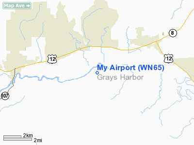
Location & QuickFacts
| FAA Information Effective: | 2008-09-25 |
| Airport Identifier: | WN65 |
| Airport Status: | Operational |
| Longitude/Latitude: | 123-28-36.5790W/46-58-21.3460N
-123.476828/46.972596 (Estimated) |
| Elevation: | 80 ft / 24.38 m (Estimated) |
| Land: | 27 acres |
| From nearest city: | 8 nautical miles SW of Elma, WA |
| Location: | Grays Harbor County, WA |
| Magnetic Variation: | 21E (1980) |
Owner & Manager
| Ownership: | Privately owned |
| Owner: | Mark & Carol Demeerleer |
| Address: | Po Box 3333
Mccleary, WA 98557 |
| Phone number: | 360-495-0011 |
| Manager: | 245 North Middlesex Road |
| Address: | Po Box 3333
Mccleary, WA 98557 |
| Phone number: | 360-495-0011 |
Airport Operations and Facilities
| Airport Use: | Private |
| Segmented Circle: | No |
| Control Tower: | No |
| Sectional chart: | Seattle |
| Region: | ANM - Northwest Mountain |
| Boundary ARTCC: | ZSE - Seattle |
| Tie-in FSS: | SEA - Seattle |
| FSS Toll Free: | 1-800-WX-BRIEF |
Runway Information
Runway 09/27
| Dimension: | 1400 x 60 ft / 426.7 x 18.3 m |
| Surface: | ASPH-TRTD, Poor Condition
RY 09/27 ASPH CONDITION POOR DUE TO CRUMBLY CHIP SEAL. |
| |
Runway 09 |
Runway 27 |
| Traffic Pattern: | Left | Left |
| Obstruction: | | 100 ft trees, 300.0 ft from runway |
|
Radio Navigation Aids
| ID |
Type |
Name |
Ch |
Freq |
Var |
Dist |
| MNC | NDB | Mason County | | 348.00 | 19E | 23.0 nm |
| CAN | NDB | Carney | | 274.00 | 20E | 37.0 nm |
| GR | NDB | Graye | | 216.00 | 18E | 37.3 nm |
| LAC | NDB | Lacomas | | 328.00 | 18E | 37.8 nm |
| TDO | NDB | Toledo | | 219.00 | 20E | 40.4 nm |
| PWT | NDB | Kitsap | | 206.00 | 20E | 42.9 nm |
| OLM | VORTAC | Olympia | 081X | 113.40 | 19E | 23.6 nm |
| HQM | VORTAC | Hoquiam | 124X | 117.70 | 19E | 27.6 nm |
| TCM | VORTAC | Mcchord | 033X | 109.60 | 22E | 42.3 nm |
Images and information placed above are from
http://www.airport-data.com/airport/WN65/
We thank them for the data!
| General Info
|
| Country |
United States
|
| State |
WASHINGTON
|
| FAA ID |
WN65
|
| Latitude |
46-58-21.346N
|
| Longitude |
123-28-36.579W
|
| Elevation |
80 feet
|
| Near City |
ELMA
|
We don't guarantee the information is fresh and accurate. The data may
be wrong or outdated.
For more up-to-date information please refer to other sources.
|
|


