 |
|
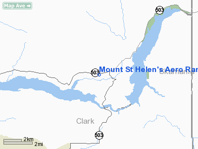
Mount St Helen's Aero Ranch Airport |
Location & QuickFacts
| FAA Information Effective: | 2008-09-25 |
| Airport Identifier: | WN10 |
| Airport Status: | Operational |
| Longitude/Latitude: | 122-22-46.3510W/45-59-36.3980N
-122.379542/45.993444 (Estimated) |
| Elevation: | 450 ft / 137.16 m (Estimated) |
| Land: | 22 acres |
| From nearest city: | 5 nautical miles SW of Cougar, WA |
| Location: | Cowlitz County, WA |
| Magnetic Variation: | 20E (1985) |
Owner & Manager
| Ownership: | Privately owned |
| Owner: | George Albertson |
| Address: | 11909 Lewis River Rd
Ariel, WA 98603 |
| Phone number: | 206-231-4223 |
| Manager: | George Albertson |
| Address: | 11869 Lewis River Rd
Ariel, WA 98603 |
| Phone number: | 206-231-4223 |
Airport Operations and Facilities
| Airport Use: | Private |
| Wind indicator: | Yes |
| Segmented Circle: | No |
| Control Tower: | No |
| Landing fee charge: | No |
| Sectional chart: | Seattle |
| Region: | ANM - Northwest Mountain |
| Boundary ARTCC: | ZSE - Seattle |
| Tie-in FSS: | SEA - Seattle |
| FSS on Airport: | No |
| FSS Toll Free: | 1-800-WX-BRIEF |
Runway Information
Runway 07/25
| Dimension: | 2600 x 100 ft / 792.5 x 30.5 m |
| Surface: | TURF, |
| |
Runway 07 |
Runway 25 |
| Traffic Pattern: | Left | Left |
| Obstruction: | 8 ft fence | 35 ft trees, 0.0 ft from runway |
|
Radio Navigation Aids
| ID |
Type |
Name |
Ch |
Freq |
Var |
Dist |
| LSO | NDB | Kelso | | 256.00 | 21E | 24.3 nm |
| LBH | NDB | Laker | | 332.00 | 20E | 27.4 nm |
| TDO | NDB | Toledo | | 219.00 | 20E | 34.2 nm |
| PND | NDB | Banks | | 356.00 | 21E | 35.4 nm |
| CBU | TACAN | Columbia | 029X | | 20E | 26.2 nm |
| PDX | VOR/DME | Portland | 055X | 111.80 | 20E | 25.8 nm |
| UBG | VOR/DME | Newberg | 121X | 117.40 | 21E | 46.0 nm |
| BTG | VORTAC | Battle Ground | 113X | 116.60 | 21E | 17.2 nm |
| PDX | VOT | Portland Intl | | 111.00 | | 25.5 nm |
| HIO | VOT | Portland-hillsboro | | 115.20 | | 36.2 nm |
Remarks
- CATTLE MAY BE ON RWY, ESPECIALLY NOV-MAR
Images and information placed above are from
http://www.airport-data.com/airport/WN10/
We thank them for the data!
| General Info
|
| Country |
United States
|
| State |
WASHINGTON
|
| FAA ID |
WN10
|
| Latitude |
45-59-36.398N
|
| Longitude |
122-22-46.351W
|
| Elevation |
450 feet
|
| Near City |
COUGAR
|
We don't guarantee the information is fresh and accurate. The data may
be wrong or outdated.
For more up-to-date information please refer to other sources.
|
|


