 |
|
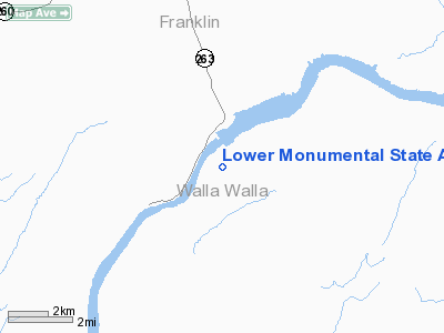
Lower Monumental State Airport |
Location & QuickFacts
| FAA Information Effective: | 2008-09-25 |
| Airport Identifier: | W09 |
| Airport Status: | Operational |
| Longitude/Latitude: | 118-32-10.9480W/46-33-01.5050N
-118.536374/46.550418 (Estimated) |
| Elevation: | 813 ft / 247.80 m (Surveyed) |
| Land: | 0 acres |
| From nearest city: | 5 nautical miles S of Kahlotus, WA |
| Location: | Walla Walla County, WA |
| Magnetic Variation: | 19E (1985) |
Owner & Manager
| Ownership: | Publicly owned |
| Owner: | Wsdot Aviation Division |
| Address: | 3704 172nd Street Ne, Suite K2, Box 3367
Arlington, WA 98223-6336 |
| Phone number: | 360-651-6300 |
| Manager: | Jim Scott |
| Address: | 3704 172nd Street Ne, Suite K2, Box 3367
Arlington, WA 98223-6336 |
| Phone number: | 800-552-0666 |
Airport Operations and Facilities
| Airport Use: | Open to public |
| Wind indicator: | Yes |
| Segmented Circle: | No |
| Control Tower: | No |
| Landing fee charge: | No |
| Sectional chart: | Seattle |
| Region: | ANM - Northwest Mountain |
| Boundary ARTCC: | ZSE - Seattle |
| Tie-in FSS: | SEA - Seattle |
| FSS on Airport: | No |
| FSS Toll Free: | 1-800-WX-BRIEF |
| NOTAMs Facility: | SEA (NOTAM-d service avaliable) |
Airport Communications
Airport Services
| Airframe Repair: | NONE |
| Power Plant Repair: | NONE |
| Bottled Oxygen: | NONE |
| Bulk Oxygen: | NONE |
Runway Information
Runway 01/19
| Dimension: | 3300 x 50 ft / 1005.8 x 15.2 m |
| Surface: | GRAVEL, Good Condition |
| |
Runway 01 |
Runway 19 |
| Traffic Pattern: | Left | Left |
| Obstruction: | 680 ft tower, 6800.0 ft from runway, 10:1 slope to clear | 115 ft pline, 2300.0 ft from runway, 20:1 slope to clear |
|
Radio Navigation Aids
| ID |
Type |
Name |
Ch |
Freq |
Var |
Dist |
| MW | NDB | Pelly | | 408.00 | 18E | 45.6 nm |
| PSC | VOR/DME | Pasco | 021X | 108.40 | 20E | 29.6 nm |
| ALW | VOR/DME | Walla Walla | 111X | 116.40 | 20E | 29.6 nm |
Remarks
- ARPT CLSD 1 OCT TO 1 JUN.
- CTC WASHINGTON STATE AVIATION DIVISION 360-651-6300 OR 1-800-552-0666 FOR FACILITY INFORMATION PRIOR TO USING.
- RWY 01/19 HAS STEEP CANYON WALLS N. E. AND S.
- MULTIPLE POWERLINES 0.4 MILE NNE OF AIRPORT.
- WATCH FOR PEDESTRIAN; VEHICLES AND ANIMALS ON RWY.
- DENSITY ALTITUDE.
- PRVDD THE FOLLOWING APPEARS IN TH AIM; MULTIPLE POWER LINES 0.4 MI NNE OF ARPT. CAUTION; RWY ROUGH; ROCK SURFACE.
Images and information placed above are from
http://www.airport-data.com/airport/W09/
We thank them for the data!
| General Info
|
| Country |
United States
|
| State |
WASHINGTON
|
| FAA ID |
W09
|
| Latitude |
46-33-01.505N
|
| Longitude |
118-32-10.948W
|
| Elevation |
813 feet
|
| Near City |
KAHLOTUS
|
We don't guarantee the information is fresh and accurate. The data may
be wrong or outdated.
For more up-to-date information please refer to other sources.
|
|


