 |
|
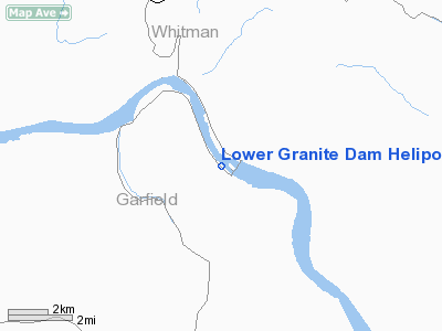
Lower Granite Dam Heliport |
Location & QuickFacts
| FAA Information Effective: | 2008-09-25 |
| Airport Identifier: | WN43 |
| Airport Status: | Operational |
| Longitude/Latitude: | 117-26-16.6570W/46-39-40.5720N
-117.437960/46.661270 (Estimated) |
| Elevation: | 652 ft / 198.73 m (Estimated) |
| Land: | 1 acres |
| From nearest city: | 14 nautical miles S of Colfax, WA |
| Location: | Garfield County, WA |
| Magnetic Variation: | 19E (1984) |
Owner & Manager
| Ownership: | Publicly owned |
| Owner: | U.s. Army Corps Of Engineers |
| Address: | Rt 3, Box 54
Pomeroy, WA 99347 |
| Phone number: | 509-843-1493 |
| Manager: | Charles R. Krahenbuhl |
| Address: | Rt 3, Box 54
Pomeroy, WA 99347 |
| Phone number: | 509-843-1493 |
Airport Operations and Facilities
| Airport Use: | Private |
| Wind indicator: | No |
| Segmented Circle: | No |
| Control Tower: | No |
| Landing fee charge: | No |
| Sectional chart: | Seattle |
| Region: | ANM - Northwest Mountain |
| Boundary ARTCC: | ZSE - Seattle |
| Tie-in FSS: | SEA - Seattle |
| FSS on Airport: | No |
| FSS Toll Free: | 1-800-WX-BRIEF |
Runway Information
Helipad H1
| Dimension: | 28 x 28 ft / 8.5 x 8.5 m |
| Surface: | ASPH, Good Condition |
| |
Runway H1 |
Runway |
| Traffic Pattern: | Left | Left |
|
Radio Navigation Aids
| ID |
Type |
Name |
Ch |
Freq |
Var |
Dist |
| PUW | VOR/DME | Pullman | 027X | 109.00 | 20E | 8.9 nm |
| MQG | VOR/DME | Nez Perce | 019X | 108.20 | 20E | 28.9 nm |
| ALW | VOR/DME | Walla Walla | 111X | 116.40 | 20E | 49.5 nm |
Images and information placed above are from
http://www.airport-data.com/airport/WN43/
We thank them for the data!
| General Info
|
| Country |
United States
|
| State |
WASHINGTON
|
| FAA ID |
WN43
|
| Latitude |
46-39-40.572N
|
| Longitude |
117-26-16.657W
|
| Elevation |
652 feet
|
| Near City |
COLFAX
|
We don't guarantee the information is fresh and accurate. The data may
be wrong or outdated.
For more up-to-date information please refer to other sources.
|
|


