 |
|
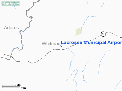
Location & QuickFacts
| FAA Information Effective: | 2008-09-25 |
| Airport Identifier: | WA30 |
| Airport Status: | Operational |
| Longitude/Latitude: | 117-55-16.7920W/46-47-27.5570N
-117.921331/46.790988 (Estimated) |
| Elevation: | 1491 ft / 454.46 m (Estimated) |
| Land: | 87 acres |
| From nearest city: | 2 nautical miles SW of Lacrosse, WA |
| Location: | Whitman County, WA |
| Magnetic Variation: | 19E (1985) |
Owner & Manager
| Ownership: | Privately owned |
| Owner: | John H Nelson |
| Address: | Po Box 376
La Crosse, WA 99143 |
| Phone number: | 509-549-3597 |
| Manager: | John H Nelson |
| Address: | Po Box 376
La Crosse, WA 99143 |
| Phone number: | 509-549-3597 |
Airport Operations and Facilities
| Airport Use: | Private |
| Wind indicator: | Yes |
| Segmented Circle: | No |
| Control Tower: | No |
| Lighting Schedule: | PHONE REQ
FOR LGTS CALL 509-549-3597. |
| Landing fee charge: | No |
| Sectional chart: | Seattle |
| Region: | ANM - Northwest Mountain |
| Boundary ARTCC: | ZSE - Seattle |
| Tie-in FSS: | SEA - Seattle |
| FSS on Airport: | No |
| FSS Toll Free: | 1-800-WX-BRIEF |
Airport Services
| Airframe Repair: | NONE |
| Power Plant Repair: | NONE |
| Bottled Oxygen: | NONE |
| Bulk Oxygen: | NONE |
Runway Information
Runway 04/22
| Dimension: | 3690 x 50 ft / 1124.7 x 15.2 m |
| Surface: | TURF,
TURF; APRX 50' MOWED; RWY RUF-FAIR TO POOR COND. |
| |
Runway 04 |
Runway 22 |
| Traffic Pattern: | Left | Left |
| Runway End Identifier: | No | No |
| Centerline Lights: | No | No |
| Touchdown Lights: | No | No |
| Obstruction: | 4 ft fence | 4 ft fence, 0.0 ft from runway |
|
Runway 12/30
| Dimension: | 2400 x 30 ft / 731.5 x 9.1 m |
| Surface: | ASPH,
TURF; APRX 50' MOWED; RWY RUF-FAIR TO POOR COND. |
| |
Runway 12 |
Runway 30 |
| Traffic Pattern: | Left | Left |
| Runway End Identifier: | No | No |
| Centerline Lights: | No | No |
| Touchdown Lights: | No | No |
| Obstruction: | 26 ft pole, 260.0 ft from runway, 90 ft right of centerline, 2:1 slope to clear
4' FENCE AT 0'. | , 50:1 slope to clear |
|
Radio Navigation Aids
| ID |
Type |
Name |
Ch |
Freq |
Var |
Dist |
| PUW | VOR/DME | Pullman | 027X | 109.00 | 20E | 29.6 nm |
| ALW | VOR/DME | Walla Walla | 111X | 116.40 | 20E | 45.0 nm |
| MQG | VOR/DME | Nez Perce | 019X | 108.20 | 20E | 49.9 nm |
| GEG | VORTAC | Spokane | 102X | 115.50 | 21E | 48.1 nm |
Remarks
- FRQNT AG OPNS.
- CONTACT OWNER AT 509-545-3597 FOR PRIOR PERMISSION.
- 900' TURF/DIRT OVERRUN DEPARTURE END RWY 12.
- EXISTED PRIOR TO 1959.
Images and information placed above are from
http://www.airport-data.com/airport/WA30/
We thank them for the data!
| General Info
|
| Country |
United States
|
| State |
WASHINGTON
|
| FAA ID |
WA30
|
| Latitude |
46-47-27.557N
|
| Longitude |
117-55-16.792W
|
| Elevation |
1491 feet
|
| Near City |
LACROSSE
|
We don't guarantee the information is fresh and accurate. The data may
be wrong or outdated.
For more up-to-date information please refer to other sources.
|
|


