 |
|
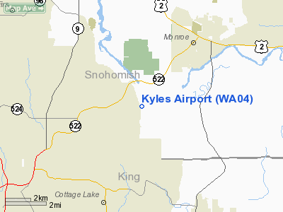
Location & QuickFacts
| FAA Information Effective: | 2008-09-25 |
| Airport Identifier: | WA04 |
| Airport Status: | Operational |
| Longitude/Latitude: | 122-02-36.0000W/47-48-48.0000N
-122.043333/47.813333 (Estimated) |
| Elevation: | 470 ft / 143.26 m (Estimated) |
| Land: | 5 acres |
| From nearest city: | 7 nautical miles SE of Snohomish, WA |
| Location: | Snohomish County, WA |
| Magnetic Variation: | () |
Owner & Manager
| Ownership: | Privately owned |
| Owner: | Allyn & James Kyle |
| Address: | 20225 Welch Rd
Snohomish, WA 98296 |
| Phone number: | 360-668-3736 |
| Manager: | Allyn Kyle |
| Address: | 20225 Welch Rd
Snohomish, WA 98296 |
| Phone number: | 360-668-3736 |
Airport Operations and Facilities
| Airport Use: | Private |
| Wind indicator: | Yes |
| Control Tower: | No |
| Sectional chart: | Seattle |
| Region: | ANM - Northwest Mountain |
| Boundary ARTCC: | ZSE - Seattle |
| Tie-in FSS: | SEA - Seattle |
| FSS Toll Free: | 1-800-WX-BRIEF |
Runway Information
Runway 15/33
| Dimension: | 1800 x 30 ft / 548.6 x 9.1 m |
| Surface: | TURF, |
| |
Runway 15 |
Runway 33 |
| Traffic Pattern: | Left | Left |
| Obstruction: | 25 ft trees, 100.0 ft from runway | 80 ft trees, 0.0 ft from runway |
|
Radio Navigation Aids
| ID |
Type |
Name |
Ch |
Freq |
Var |
Dist |
| RNT | NDB | Renton | | 353.00 | 20E | 20.3 nm |
| ODD | NDB | Dondo | | 224.00 | 19E | 29.1 nm |
| PWT | NDB | Kitsap | | 206.00 | 20E | 34.7 nm |
| CAN | NDB | Carney | | 274.00 | 20E | 40.3 nm |
| BVS | NDB | Skagit/bay View | | 240.00 | 21E | 42.2 nm |
| GR | NDB | Graye | | 216.00 | 18E | 45.9 nm |
| NUW | TACAN | Whidbey Island | 085X | | 21E | 40.9 nm |
| PAE | VOR/DME | Paine | 043X | 110.60 | 20E | 11.4 nm |
| CVV | VOR/DME | Penn Cove | 119X | 117.20 | 19E | 37.7 nm |
| SEA | VORTAC | Seattle | 115X | 116.80 | 19E | 25.1 nm |
| TCM | VORTAC | Mcchord | 033X | 109.60 | 22E | 43.7 nm |
| BFI | VOT | Boeing Field | | 108.60 | | 20.1 nm |
| SEA | VOT | Seattle-tacoma | | 117.50 | | 24.6 nm |
Images and information placed above are from
http://www.airport-data.com/airport/WA04/
We thank them for the data!
| General Info
|
| Country |
United States
|
| State |
WASHINGTON
|
| FAA ID |
WA04
|
| Latitude |
46-22-39.452N
|
| Longitude |
120-45-19.251W
|
| Elevation |
1015 feet
|
| Near City |
WHITE SWAN
|
We don't guarantee the information is fresh and accurate. The data may
be wrong or outdated.
For more up-to-date information please refer to other sources.
|
|


