 |
|
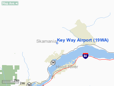
Location & QuickFacts
| FAA Information Effective: | 2008-09-25 |
| Airport Identifier: | 19WA |
| Airport Status: | Operational |
| Longitude/Latitude: | 121-53-10.2870W/45-43-10.4190N
-121.886191/45.719561 (Estimated) |
| Elevation: | 972 ft / 296.27 m (Surveyed) |
| Land: | 0 acres |
| From nearest city: | 2 nautical miles N of Stevenson, WA |
| Location: | Skamania County, WA |
| Magnetic Variation: | 19E (1985) |
Owner & Manager
| Ownership: | Privately owned |
| Owner: | Jay T. Hafford |
| Address: | 2681 Loop Road
Stevenson, WA 98648 |
| Phone number: | 509-427-8722 |
| Manager: | Jay Hafford |
| Address: | 2681 Loop Road
Stevenson, WA 98648 |
| Phone number: | 509-427-8722 |
Airport Operations and Facilities
| Airport Use: | Private |
| Wind indicator: | No |
| Segmented Circle: | No |
| Control Tower: | No |
| Lighting Schedule: | PHONE REQ
FOR RWY LGTS CALL 509-427-8722. |
| Landing fee charge: | No |
| Sectional chart: | Seattle |
| Region: | ANM - Northwest Mountain |
| Boundary ARTCC: | ZSE - Seattle |
| Tie-in FSS: | SEA - Seattle |
| FSS on Airport: | No |
| FSS Toll Free: | 1-800-WX-BRIEF |
Runway Information
Runway 15/33
| Dimension: | 2300 x 100 ft / 701.0 x 30.5 m |
| Surface: | TURF, |
| Edge Lights: | Low |
| |
Runway 15 |
Runway 33 |
| Traffic Pattern: | Left | Left |
|
Radio Navigation Aids
| ID |
Type |
Name |
Ch |
Freq |
Var |
Dist |
| LBH | NDB | Laker | | 332.00 | 20E | 26.5 nm |
| PND | NDB | Banks | | 356.00 | 21E | 49.0 nm |
| CBU | TACAN | Columbia | 029X | | 20E | 31.5 nm |
| PDX | VOR/DME | Portland | 055X | 111.80 | 20E | 31.2 nm |
| LTJ | VOR/DME | Klickitat | 070X | 112.30 | 21E | 33.0 nm |
| BTG | VORTAC | Battle Ground | 113X | 116.60 | 21E | 29.6 nm |
| PDX | VOT | Portland Intl | | 111.00 | | 30.9 nm |
| HIO | VOT | Portland-hillsboro | | 115.20 | | 45.9 nm |
Remarks
- ONE WAY STRIP. APCH FM S ONLY.
- POSSIBLE WILDLIFE ON RY.
Images and information placed above are from
http://www.airport-data.com/airport/19WA/
We thank them for the data!
| General Info
|
| Country |
United States
|
| State |
WASHINGTON
|
| FAA ID |
19WA
|
| Latitude |
45-43-10.419N
|
| Longitude |
121-53-10.287W
|
| Elevation |
972 feet
|
| Near City |
STEVENSON
|
We don't guarantee the information is fresh and accurate. The data may
be wrong or outdated.
For more up-to-date information please refer to other sources.
|
|


