 |
|
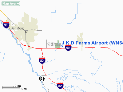
Location & QuickFacts
| FAA Information Effective: | 2008-09-25 |
| Airport Identifier: | WN64 |
| Airport Status: | Operational |
| Longitude/Latitude: | 120-27-43.2400W/46-58-27.4540N
-120.462011/46.974293 (Estimated) |
| Elevation: | 1575 ft / 480.06 m (Estimated) |
| Land: | 0 acres |
| From nearest city: | 4 nautical miles SE of Ellensburg, WA |
| Location: | Kittitas County, WA |
| Magnetic Variation: | 20E (1980) |
Owner & Manager
| Ownership: | Privately owned |
| Owner: | John R. Gibb |
| Address: | Rt 5, Box 2590
Ellensburg, WA 98926 |
| Phone number: | 509-925-1843 |
| Address: |
|
Airport Operations and Facilities
| Airport Use: | Private |
| Wind indicator: | Yes |
| Segmented Circle: | No |
| Control Tower: | No |
| Sectional chart: | Seattle |
| Region: | ANM - Northwest Mountain |
| Boundary ARTCC: | ZSE - Seattle |
| Tie-in FSS: | SEA - Seattle |
| FSS Toll Free: | 1-800-WX-BRIEF |
Runway Information
Runway 16/34
| Dimension: | 2500 x 60 ft / 762.0 x 18.3 m |
| Surface: | GRVL, |
| |
Runway 16 |
Runway 34 |
| Traffic Pattern: | Left | Left |
|
Radio Navigation Aids
| ID |
Type |
Name |
Ch |
Freq |
Var |
Dist |
| EAT | FAN MARKER | Malaga | | | 21E | 26.7 nm |
| MW | NDB | Pelly | | 408.00 | 18E | 49.4 nm |
| EAT | VOR/DME | Wenatchee | 047X | 111.00 | 19E | 27.6 nm |
| MWH | VOR/DME | Moses Lake | 097X | 115.00 | 18E | 49.0 nm |
| ELN | VORTAC | Ellensburg | 126X | 117.90 | 21E | 3.0 nm |
| YKM | VORTAC | Yakima | 107X | 116.00 | 21E | 24.3 nm |
| EPH | VORTAC | Ephrata | 073X | 112.60 | 21E | 48.9 nm |
Images and information placed above are from
http://www.airport-data.com/airport/WN64/
We thank them for the data!
| General Info
|
| Country |
United States
|
| State |
WASHINGTON
|
| FAA ID |
WN64
|
| Latitude |
46-58-27.454N
|
| Longitude |
120-27-43.240W
|
| Elevation |
1575 feet
|
| Near City |
ELLENSBURG
|
We don't guarantee the information is fresh and accurate. The data may
be wrong or outdated.
For more up-to-date information please refer to other sources.
|
|


