 |
|
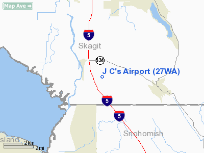
Location & QuickFacts
| FAA Information Effective: | 2008-09-25 |
| Airport Identifier: | 27WA |
| Airport Status: | Operational |
| Longitude/Latitude: | 122-18-56.5560W/48-19-30.3680N
-122.315710/48.325102 (Estimated) |
| Elevation: | 236 ft / 71.93 m (Estimated) |
| Land: | 20 acres |
| From nearest city: | 1 nautical miles SE of Conway, WA |
| Location: | Skagit County, WA |
| Magnetic Variation: | 21E (1985) |
Owner & Manager
| Ownership: | Privately owned |
| Owner: | Jerry C Qwens |
| Address: | 2198 Bulson Rd
Mt Vernon, WA 98273 |
| Phone number: | 206-445-3200 |
| Manager: | Jerry C Owens |
| Address: | 2198 Bulson Rd
Mt Vernon, WA 98273 |
| Phone number: | 206-445-3200 |
Airport Operations and Facilities
| Airport Use: | Private |
| Wind indicator: | Yes |
| Segmented Circle: | No |
| Control Tower: | No |
| Sectional chart: | Seattle |
| Region: | ANM - Northwest Mountain |
| Boundary ARTCC: | ZSE - Seattle |
| Tie-in FSS: | SEA - Seattle |
| FSS Toll Free: | 1-800-WX-BRIEF |
Airport Communications
Runway Information
Runway 07/25
| Dimension: | 1200 x 30 ft / 365.8 x 9.1 m |
| Surface: | TURF, |
| |
Runway 07 |
Runway 25 |
| Traffic Pattern: | Left | Left |
| Obstruction: | 4 ft fence, 5.0 ft from runway | 150 ft trees, 800.0 ft from runway |
|
Radio Navigation Aids
| ID |
Type |
Name |
Ch |
Freq |
Var |
Dist |
| BVS | NDB | Skagit/bay View | | 240.00 | 21E | 9.6 nm |
| OPZ | NDB | Lopez Island | | 356.00 | 21E | 25.9 nm |
| FHR | NDB | Friday Harbor | | 284.00 | 20E | 30.9 nm |
| XX | NDB | Abbotsford | | 344.00 | 21E | 42.0 nm |
| LU | NDB | Cultus | | 214.00 | 22E | 43.2 nm |
| WC | NDB | White Rock | | 332.00 | 21E | 44.0 nm |
| YJ | NDB | Victoria | | 200.00 | 21E | 47.2 nm |
| NUW | TACAN | Whidbey Island | 085X | | 21E | 13.9 nm |
| CVV | VOR/DME | Penn Cove | 119X | 117.20 | 19E | 17.0 nm |
| PAE | VOR/DME | Paine | 043X | 110.60 | 20E | 24.4 nm |
| HUH | VORTAC | Whatcom | 077X | 113.00 | 20E | 38.7 nm |
| BFI | VOT | Boeing Field | | 108.60 | | 47.9 nm |
Remarks
- POTHOLES
- SOFT IN WINTER AND SPRING.
Images and information placed above are from
http://www.airport-data.com/airport/27WA/
We thank them for the data!
| General Info
|
| Country |
United States
|
| State |
WASHINGTON
|
| FAA ID |
27WA
|
| Latitude |
48-19-30.368N
|
| Longitude |
122-18-56.556W
|
| Elevation |
236 feet
|
| Near City |
CONWAY
|
We don't guarantee the information is fresh and accurate. The data may
be wrong or outdated.
For more up-to-date information please refer to other sources.
|
|


