 |
|
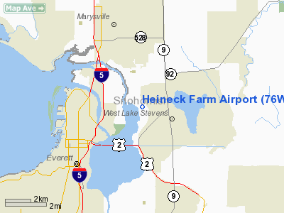
Location & QuickFacts
| FAA Information Effective: | 2008-09-25 |
| Airport Identifier: | 76WA |
| Airport Status: | Operational |
| Longitude/Latitude: | 122-08-01.4810W/48-00-18.3480N
-122.133745/48.005097 (Estimated) |
| Elevation: | 10 ft / 3.05 m (Estimated) |
| Land: | 0 acres |
| From nearest city: | 3 nautical miles NE of Everett, WA |
| Location: | Snohomish County, WA |
| Magnetic Variation: | 21E (1985) |
Owner & Manager
| Ownership: | Privately owned |
| Owner: | Joseph B Heineck |
| Address: | 930 Sunnyside Blvd
Everett, WA 98205 |
| Phone number: | 206-334-6100
BUSINESS |
| Manager: | Joseph B Heineck |
| Address: | 930 Sunnyside Blvd
Everett, WA 98205 |
| Phone number: | 206-334-6100 |
Airport Operations and Facilities
| Airport Use: | Private |
| Wind indicator: | No |
| Segmented Circle: | No |
| Control Tower: | No |
| Landing fee charge: | No |
| Sectional chart: | Seattle |
| Region: | ANM - Northwest Mountain |
| Boundary ARTCC: | ZSE - Seattle |
| Tie-in FSS: | SEA - Seattle |
| FSS on Airport: | No |
| FSS Toll Free: | 1-800-WX-BRIEF |
Runway Information
Runway 07/25
| Dimension: | 2500 x 75 ft / 762.0 x 22.9 m |
| Surface: | TURF, |
| |
Runway 07 |
Runway 25 |
| Traffic Pattern: | Left | Left |
| Obstruction: | , 200.0 ft from runway | 60 ft plines, 100.0 ft from runway |
|
Radio Navigation Aids
| ID |
Type |
Name |
Ch |
Freq |
Var |
Dist |
| BVS | NDB | Skagit/bay View | | 240.00 | 21E | 30.1 nm |
| RNT | NDB | Renton | | 353.00 | 20E | 30.8 nm |
| ODD | NDB | Dondo | | 224.00 | 19E | 39.2 nm |
| PWT | NDB | Kitsap | | 206.00 | 20E | 39.8 nm |
| OPZ | NDB | Lopez Island | | 356.00 | 21E | 42.5 nm |
| CAN | NDB | Carney | | 274.00 | 20E | 45.7 nm |
| FHR | NDB | Friday Harbor | | 284.00 | 20E | 47.6 nm |
| NUW | TACAN | Whidbey Island | 085X | | 21E | 29.8 nm |
| PAE | VOR/DME | Paine | 043X | 110.60 | 20E | 7.7 nm |
| CVV | VOR/DME | Penn Cove | 119X | 117.20 | 19E | 27.7 nm |
| SEA | VORTAC | Seattle | 115X | 116.80 | 19E | 35.0 nm |
| BFI | VOT | Boeing Field | | 108.60 | | 29.5 nm |
| SEA | VOT | Seattle-tacoma | | 117.50 | | 34.5 nm |
Remarks
- RWY 07/25 STRIP SOFT WHEN WET.
Images and information placed above are from
http://www.airport-data.com/airport/76WA/
We thank them for the data!
| General Info
|
| Country |
United States
|
| State |
WASHINGTON
|
| FAA ID |
76WA
|
| Latitude |
48-00-18.348N
|
| Longitude |
122-08-01.481W
|
| Elevation |
10 feet
|
| Near City |
EVERETT
|
We don't guarantee the information is fresh and accurate. The data may
be wrong or outdated.
For more up-to-date information please refer to other sources.
|
|


