 |
|
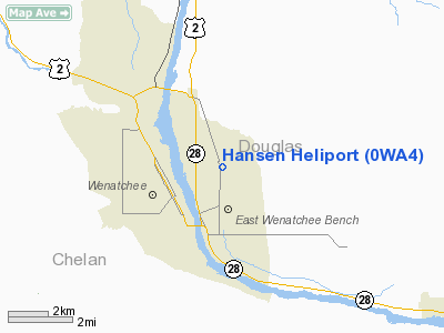
Location & QuickFacts
| FAA Information Effective: | 2008-09-25 |
| Airport Identifier: | 0WA4 |
| Airport Status: | Operational |
| Longitude/Latitude: | 120-16-46.2540W/47-26-10.4570N
-120.279515/47.436238 (Estimated) |
| Elevation: | 1250 ft / 381.00 m (Estimated) |
| Land: | 0 acres |
| From nearest city: | 3 nautical miles NE of East Wenatchee, WA |
| Location: | Grant County, WA |
| Magnetic Variation: | 20E (1985) |
Owner & Manager
| Ownership: | Privately owned |
| Owner: | Darrell L Hansen |
| Address: | 1939 Valley View Blvd
E. Wenatchee, WA 98801 |
| Manager: | Darrell L Hansen |
| Address: | 1939 Valley View Blvd
E. Wenatchee, WA 98801 |
| Phone number: | 509-884-3312 |
Airport Operations and Facilities
| Airport Use: | Private |
| Wind indicator: | Yes |
| Segmented Circle: | No |
| Control Tower: | No |
| Lighting Schedule: | PHONE REQ
|
| Landing fee charge: | No |
| Sectional chart: | Seattle |
| Region: | ANM - Northwest Mountain |
| Boundary ARTCC: | ZSE - Seattle |
| Tie-in FSS: | SEA - Seattle |
| FSS on Airport: | No |
| FSS Toll Free: | 1-800-WX-BRIEF |
Runway Information
Helipad H1
| Dimension: | 100 x 50 ft / 30.5 x 15.2 m |
| Surface: | ASPH,
ROOF TOP. |
| Edge Lights: | Low |
| |
Runway H1 |
Runway |
| Traffic Pattern: | Left | Left |
|
Radio Navigation Aids
| ID |
Type |
Name |
Ch |
Freq |
Var |
Dist |
| EAT | FAN MARKER | Malaga | | | 21E | 7.4 nm |
| MW | NDB | Pelly | | 408.00 | 18E | 45.3 nm |
| EAT | VOR/DME | Wenatchee | 047X | 111.00 | 19E | 3.6 nm |
| MWH | VOR/DME | Moses Lake | 097X | 115.00 | 18E | 41.5 nm |
| ELN | VORTAC | Ellensburg | 126X | 117.90 | 21E | 25.8 nm |
| EPH | VORTAC | Ephrata | 073X | 112.60 | 21E | 35.0 nm |
Remarks
- PRVDD A MUTUALLY SATISFACTORY OPERATIONAL AGREEMENT IS REACHED BETWEEN THE PROPONENT AND THE OPERATOR OF FANCHER FIELD.
Images and information placed above are from
http://www.airport-data.com/airport/0WA4/
We thank them for the data!
| General Info
|
| Country |
United States
|
| State |
WASHINGTON
|
| FAA ID |
0WA4
|
| Latitude |
47-26-10.457N
|
| Longitude |
120-16-46.254W
|
| Elevation |
1250 feet
|
| Near City |
EAST WENATCHEE
|
We don't guarantee the information is fresh and accurate. The data may
be wrong or outdated.
For more up-to-date information please refer to other sources.
|
|


