 |
|
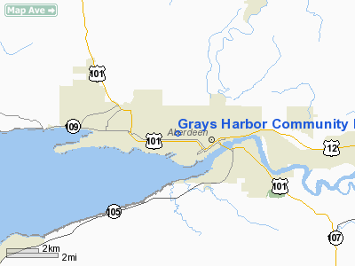
Grays Harbor Community Hospital Heliport |
Location & QuickFacts
| FAA Information Effective: | 2008-09-25 |
| Airport Identifier: | WT00 |
| Airport Status: | Operational |
| Longitude/Latitude: | 123-50-49.7000W/46-58-46.9400N
-123.847139/46.979706 (Estimated) |
| Elevation: | 700 ft / 213.36 m (Estimated) |
| Land: | 0 acres |
| From nearest city: | 1 nautical miles S of Aberdeen, WA |
| Location: | Grays Harbor County, WA |
| Magnetic Variation: | () |
Owner & Manager
| Ownership: | Privately owned |
| Owner: | Grays Harbor Community Hospital |
| Address: | 915 Anderson Dr2
Aberdeen, WA 98520 |
| Phone number: | 360-532-8330 |
| Manager: | Dave Reid, Director Of Engineering |
| Address: | 915 Anderson Dr
Aberdeen, WA 98520 |
| Phone number: | 360-532-8330 |
Airport Operations and Facilities
| Airport Use: | Private |
| Control Tower: | No |
| Sectional chart: | Seattle |
| Region: | ANM - Northwest Mountain |
| Boundary ARTCC: | ZSE - Seattle |
| Tie-in FSS: | SEA - Seattle |
| FSS Toll Free: | 1-800-WX-BRIEF |
Runway Information
Helipad H1
| Dimension: | 40 x 40 ft / 12.2 x 12.2 m |
| Surface: | CONC, |
| |
Runway H1 |
Runway |
| Traffic Pattern: | Left | Left |
|
Radio Navigation Aids
| ID |
Type |
Name |
Ch |
Freq |
Var |
Dist |
| AST | FAN MARKER | Fort Stevens | | | 22E | 46.6 nm |
| MNC | NDB | Mason County | | 348.00 | 19E | 35.1 nm |
| CAN | NDB | Carney | | 274.00 | 20E | 48.7 nm |
| AST | VOR/DME | Astoria | 087X | 114.00 | 19E | 49.2 nm |
| HQM | VORTAC | Hoquiam | 124X | 117.70 | 19E | 12.5 nm |
| OLM | VORTAC | Olympia | 081X | 113.40 | 19E | 38.8 nm |
Images and information placed above are from
http://www.airport-data.com/airport/WT00/
We thank them for the data!
|
|


