 |
|
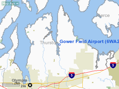
Location & QuickFacts
| FAA Information Effective: | 2008-09-25 |
| Airport Identifier: | 6WA2 |
| Airport Status: | Operational |
| Longitude/Latitude: | 122-49-16.4900W/47-06-41.3460N
-122.821247/47.111485 (Estimated) |
| Elevation: | 130 ft / 39.62 m (Estimated) |
| Land: | 0 acres |
| From nearest city: | 4 nautical miles NE of Olympia, WA |
| Location: | Thurston County, WA |
| Magnetic Variation: | 20E (1985) |
Owner & Manager
| Ownership: | Privately owned |
| Owner: | Eldon G. Flahaut |
| Address: | 5529 Johnson Point Road Ne
Olympia, WA 98506 |
| Phone number: | 206-491-5398 |
| Manager: | Eldon G. Flahaut |
| Address: | 5529 Johnson Point Road Se
Olympia, WA 98506 |
| Phone number: | 206-754-4043 |
Airport Operations and Facilities
| Airport Use: | Private |
| Wind indicator: | Yes |
| Segmented Circle: | Yes |
| Control Tower: | No |
| Lighting Schedule: | DUSK-DAWN |
| Sectional chart: | Seattle |
| Region: | ANM - Northwest Mountain |
| Boundary ARTCC: | ZSE - Seattle |
| Tie-in FSS: | SEA - Seattle |
| FSS on Airport: | No |
| FSS Toll Free: | 1-800-WX-BRIEF |
Runway Information
Runway 06/24
| Dimension: | 1800 x 40 ft / 548.6 x 12.2 m |
| Surface: | TURF, |
| Edge Lights: | Low |
| |
Runway 06 |
Runway 24 |
| Traffic Pattern: | Left | Right |
|
Runway 16W/34W
| Dimension: | 5000 x 100 ft / 1524.0 x 30.5 m |
| Surface: | WATER, |
| |
Runway 16W |
Runway 34W |
| Traffic Pattern: | Left | Left |
|
Radio Navigation Aids
| ID |
Type |
Name |
Ch |
Freq |
Var |
Dist |
| GR | NDB | Graye | | 216.00 | 18E | 9.2 nm |
| LAC | NDB | Lacomas | | 328.00 | 18E | 12.5 nm |
| MNC | NDB | Mason County | | 348.00 | 19E | 13.6 nm |
| CAN | NDB | Carney | | 274.00 | 20E | 18.0 nm |
| PWT | NDB | Kitsap | | 206.00 | 20E | 23.0 nm |
| ODD | NDB | Dondo | | 224.00 | 19E | 25.8 nm |
| RNT | NDB | Renton | | 353.00 | 20E | 33.8 nm |
| TDO | NDB | Toledo | | 219.00 | 20E | 38.2 nm |
| OLM | VORTAC | Olympia | 081X | 113.40 | 19E | 9.0 nm |
| TCM | VORTAC | Mcchord | 033X | 109.60 | 22E | 14.3 nm |
| SEA | VORTAC | Seattle | 115X | 116.80 | 19E | 28.5 nm |
| SEA | VOT | Seattle-tacoma | | 117.50 | | 29.1 nm |
| BFI | VOT | Boeing Field | | 108.60 | | 32.7 nm |
Remarks
- LNDGS TO EAST ONLY; TKOFS TO WEST ONLY.
- RWY 6 - CENTERLINE LGTS AVAILABLE DUSK-DAWN.
- PROVIDED OPNS RESTRICT TO PSNL USE...VFR DALGT USE ONLY...NOT SHOWN ON SECTIONALS.
Images and information placed above are from
http://www.airport-data.com/airport/6WA2/
We thank them for the data!
| General Info
|
| Country |
United States
|
| State |
WASHINGTON
|
| FAA ID |
6WA2
|
| Latitude |
47-06-41.346N
|
| Longitude |
122-49-16.490W
|
| Elevation |
130 feet
|
| Near City |
OLYMPIA
|
We don't guarantee the information is fresh and accurate. The data may
be wrong or outdated.
For more up-to-date information please refer to other sources.
|
|


