 |
|
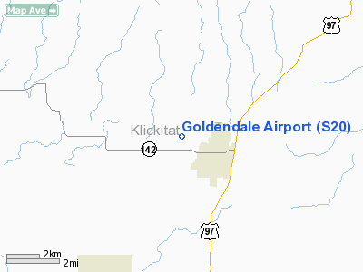
Location & QuickFacts
| FAA Information Effective: | 2008-09-25 |
| Airport Identifier: | S20 |
| Airport Status: | Operational |
| Longitude/Latitude: | 120-50-42.9890W/45-49-55.4660N
-120.845275/45.832074 (Estimated) |
| Elevation: | 1678 ft / 511.45 m (Estimated) |
| Land: | 73 acres |
| From nearest city: | 1 nautical miles NW of Goldendale, WA |
| Location: | Klickitat County, WA |
| Magnetic Variation: | 19E (1985) |
Owner & Manager
| Ownership: | Publicly owned |
| Owner: | City Of Goldendale |
| Address: | 1103 South Columbus, P.o. Box 69
Goldendale, WA 98620 |
| Phone number: | 509-773-3771 |
| Manager: | Mark Sigfrinious |
| Address: | 1103 South Columbus, P.o. Box 69
Goldendale, WA 98620 |
| Phone number: | 509-310-9441 |
Airport Operations and Facilities
| Airport Use: | Open to public |
| Wind indicator: | Yes |
| Segmented Circle: | No |
| Control Tower: | No |
| Lighting Schedule: | DUSK-DAWN |
| Beacon Color: | Clear-Green (lighted land airport) |
| Landing fee charge: | No |
| Sectional chart: | Seattle |
| Region: | ANM - Northwest Mountain |
| Boundary ARTCC: | ZSE - Seattle |
| Tie-in FSS: | SEA - Seattle |
| FSS on Airport: | No |
| FSS Toll Free: | 1-800-WX-BRIEF |
| NOTAMs Facility: | SEA (NOTAM-d service avaliable) |
Airport Communications
Airport Services
| Airframe Repair: | NONE |
| Power Plant Repair: | NONE |
| Bottled Oxygen: | NONE |
| Bulk Oxygen: | NONE |
Runway Information
Runway 07/25
| Dimension: | 3491 x 40 ft / 1064.1 x 12.2 m |
| Surface: | ASPH, Good Condition |
| Weight Limit: | Single wheel: 4000 lbs. |
| Edge Lights: | Medium |
| |
Runway 07 |
Runway 25 |
| Longitude: | 120-51-07.6340W | 120-50-18.3440W |
| Latitude: | 45-49-55.1430N | 45-49-55.7880N |
| Alignment: | 89 | 127 |
| Traffic Pattern: | Left | Left |
| Markings: | Nonstandard, Good Condition
NONSTD WHITE LINE CROSSES RWY NEAR RWY 7 MARKING. | Nonstandard, Good Condition
NONSTD WHITE LINE CROSSES RWY NEAR RWY 25 MARKING. |
| Displaced threshold: | 0.00 ft | 330.00 ft |
| VASI: | | 2-box SAVASI on left side |
| Obstruction: | 7 ft fence, 221.0 ft from runway, 102 ft right of centerline, 3:1 slope to clear
+4' FENCE AT 0' & 100' RIGHT OF CNTRLN. | 91 ft trees, 2573.0 ft from runway, 125 ft right of centerline, 26:1 slope to clear
RWY 25 APCH SLOPE 31:1 TO DSPLCD THLD.
-3' DITCH AT 15', 0' ROAD AT 35' AND 4' FENCE 75' FROM THR. |
|
Radio Navigation Aids
| ID |
Type |
Name |
Ch |
Freq |
Var |
Dist |
| LTJ | VOR/DME | Klickitat | 070X | 112.30 | 21E | 12.9 nm |
| YKM | VORTAC | Yakima | 107X | 116.00 | 21E | 47.4 nm |
Remarks
- RWY 7/25 NO LINE OF SIGHT DUE TO RWY GRADIENT.
- FENCES, DITCH, BLDGS & ROAD IN PRIMARY SURFACE.
- ESTABD PRIOR TO 15 MAY 1959.
Images and information placed above are from
http://www.airport-data.com/airport/S20/
We thank them for the data!
| General Info
|
| Country |
United States
|
| State |
WASHINGTON
|
| FAA ID |
S20
|
| Latitude |
45-49-50.445N
|
| Longitude |
120-50-15.234W
|
| Elevation |
1660 feet
|
| Near City |
GOLDENDALE
|
We don't guarantee the information is fresh and accurate. The data may
be wrong or outdated.
For more up-to-date information please refer to other sources.
|
|


