 |
|
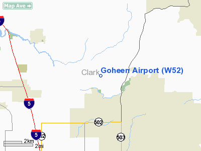
Location & QuickFacts
| FAA Information Effective: | 2008-09-25 |
| Airport Identifier: | W52 |
| Airport Status: | Operational |
| Longitude/Latitude: | 122-34-36.6820W/45-49-36.4670N
-122.576856/45.826796 (Estimated) |
| Elevation: | 292 ft / 89.00 m (Estimated) |
| Land: | 100 acres |
| From nearest city: | 3 nautical miles NW of Battle Ground, WA |
| Location: | Clark County, WA |
| Magnetic Variation: | 20E (1985) |
Owner & Manager
| Ownership: | Privately owned |
| Owner: | Gordon Goheen |
| Address: | 9304 Ne 279 St
Battle Ground, WA 98604 |
| Phone number: | 360-687-3038 |
| Manager: | G.c. Goheen |
| Address: | 9304 Ne 279th St
Battle Ground, WA 98604 |
| Phone number: | 360-687-3038 |
Airport Operations and Facilities
| Airport Use: | Open to public |
| Wind indicator: | Yes |
| Segmented Circle: | No |
| Control Tower: | No |
| Lighting Schedule: | RDO-CTL
ACTVT BCN & LIRL RY 15/33 - CTAF. |
| Beacon Color: | Clear-Green (lighted land airport) |
| Landing fee charge: | No |
| Sectional chart: | Seattle |
| Region: | ANM - Northwest Mountain |
| Boundary ARTCC: | ZSE - Seattle |
| Tie-in FSS: | SEA - Seattle |
| FSS on Airport: | No |
| FSS Toll Free: | 1-800-WX-BRIEF |
| NOTAMs Facility: | SEA (NOTAM-d service avaliable) |
Airport Communications
Airport Services
| Fuel available: | 100 |
| Airframe Repair: | MAJOR |
| Power Plant Repair: | MAJOR |
| Bulk Oxygen: | NONE |
Runway Information
Runway 07/25
| Dimension: | 1500 x 48 ft / 457.2 x 14.6 m
WIDTH OF 43' OVER CULVERT IN CENTER OF FIELD. |
| Surface: | TURF, Good Condition
SFC UNEVEN WITH AN INCLINE. |
| |
Runway 07 |
Runway 25 |
| Traffic Pattern: | Left | Left |
| Obstruction: | 5 ft fence | 124 ft tree, 858.0 ft from runway, 5:1 slope to clear |
|
Runway 15/33
| Dimension: | 2565 x 50 ft / 781.8 x 15.2 m
WIDTH OF 43' OVER CULVERT IN CENTER OF FIELD. |
| Surface: | TURF, Good Condition
SFC UNEVEN WITH AN INCLINE. |
| Edge Lights: | Low |
| |
Runway 15 |
Runway 33 |
| Longitude: | 122-34-43.3100W | 122-34-33.7830W |
| Latitude: | 45-49-51.2110N | 45-49-26.7800N |
| Traffic Pattern: | Left | Left |
| VASI: | nonstandard system
HAS NSTD SINGLE LIGHT VASI BOTH SIDES OF RY. | |
| Obstruction: | 80 ft trees, 558.0 ft from runway, 34 ft left of centerline, 6:1 slope to clear | 34 ft tree, 0.0 ft from runway, 90 ft right of centerline |
|
Radio Navigation Aids
| ID |
Type |
Name |
Ch |
Freq |
Var |
Dist |
| LBH | NDB | Laker | | 332.00 | 20E | 17.8 nm |
| PND | NDB | Banks | | 356.00 | 21E | 23.0 nm |
| LSO | NDB | Kelso | | 256.00 | 21E | 24.2 nm |
| TDO | NDB | Toledo | | 219.00 | 20E | 40.3 nm |
| PEN | NDB | Karpen | | 201.00 | 20E | 46.2 nm |
| CBU | TACAN | Columbia | 029X | | 20E | 14.4 nm |
| PDX | VOR/DME | Portland | 055X | 111.80 | 20E | 14.1 nm |
| UBG | VOR/DME | Newberg | 121X | 117.40 | 21E | 33.1 nm |
| BTG | VORTAC | Battle Ground | 113X | 116.60 | 21E | 4.8 nm |
| PDX | VOT | Portland Intl | | 111.00 | | 13.8 nm |
| HIO | VOT | Portland-hillsboro | | 115.20 | | 23.2 nm |
Remarks
- RY 07/25 FOR EMERGENCY USE ONLY.
- HANGAR N SIDE SFC 8 FT FM EDGE OF RY 25.
- E111 PRVDD 500' DSPLCD THR RWY 33.
Images and information placed above are from
http://www.airport-data.com/airport/W52/
We thank them for the data!
| General Info
|
| Country |
United States
|
| State |
WASHINGTON
|
| FAA ID |
W52
|
| Latitude |
45-49-39.413N
|
| Longitude |
122-34-34.355W
|
| Elevation |
285 feet
|
| Near City |
BATTLE GROUND
|
We don't guarantee the information is fresh and accurate. The data may
be wrong or outdated.
For more up-to-date information please refer to other sources.
|
|


