 |
|
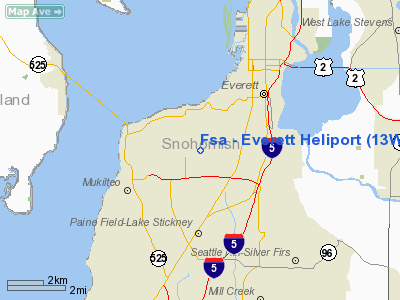
Location & QuickFacts
| FAA Information Effective: | 2008-09-25 |
| Airport Identifier: | 13WA |
| Airport Status: | Operational |
| Longitude/Latitude: | 122-14-58.4800W/47-56-11.3400N
-122.249578/47.936483 (Estimated) |
| Elevation: | 500 ft / 152.40 m (Estimated) |
| Land: | 34 acres |
| From nearest city: | 5 nautical miles N of Everett, WA |
| Location: | King County, WA |
| Magnetic Variation: | 20E (1995) |
Owner & Manager
| Ownership: | Privately owned |
| Owner: | Food Svcs Of America, Inc |
| Address: | 1001 Shuksan Way
Everett, WA 98106 |
| Phone number: | 360-933-4888 |
| Manager: | Kevin Heacox |
| Address: | 1001 Shuksan Way
Everatt, WA 98106 |
| Phone number: | 360-933-4888 |
Airport Operations and Facilities
| Airport Use: | Private |
| Wind indicator: | Yes |
| Segmented Circle: | No |
| Control Tower: | No |
| Lighting Schedule: | DUSK-DAWN |
| Sectional chart: | Seattle |
| Region: | ANM - Northwest Mountain |
| Boundary ARTCC: | ZSE - Seattle |
| Tie-in FSS: | SEA - Seattle |
| FSS Toll Free: | 1-800-WX-BRIEF |
Runway Information
Helipad H1
| Dimension: | 20 x 20 ft / 6.1 x 6.1 m |
| Surface: | CONC, |
| |
Runway H1 |
Runway |
| Traffic Pattern: | Left | Left |
|
Radio Navigation Aids
| ID |
Type |
Name |
Ch |
Freq |
Var |
Dist |
| RNT | NDB | Renton | | 353.00 | 20E | 26.5 nm |
| BVS | NDB | Skagit/bay View | | 240.00 | 21E | 32.7 nm |
| PWT | NDB | Kitsap | | 206.00 | 20E | 33.7 nm |
| ODD | NDB | Dondo | | 224.00 | 19E | 34.5 nm |
| CAN | NDB | Carney | | 274.00 | 20E | 39.6 nm |
| OPZ | NDB | Lopez Island | | 356.00 | 21E | 42.3 nm |
| FHR | NDB | Friday Harbor | | 284.00 | 20E | 47.2 nm |
| GR | NDB | Graye | | 216.00 | 18E | 49.4 nm |
| NUW | TACAN | Whidbey Island | 085X | | 21E | 30.1 nm |
| PAE | VOR/DME | Paine | 043X | 110.60 | 20E | 1.5 nm |
| CVV | VOR/DME | Penn Cove | 119X | 117.20 | 19E | 26.6 nm |
| SEA | VORTAC | Seattle | 115X | 116.80 | 19E | 30.2 nm |
| TCM | VORTAC | Mcchord | 033X | 109.60 | 22E | 48.3 nm |
| BFI | VOT | Boeing Field | | 108.60 | | 24.7 nm |
| SEA | VOT | Seattle-tacoma | | 117.50 | | 29.7 nm |
Remarks
- PRVDD WIND INDICATOR PLACED AT SITE AND COMMUNICATIONS WITH PAE ATCT IS ESTABLISHED FOR DEPARTING HELICOPTERS.
Images and information placed above are from
http://www.airport-data.com/airport/13WA/
We thank them for the data!
| General Info
|
| Country |
United States
|
| State |
WASHINGTON
|
| FAA ID |
13WA
|
| Latitude |
47-56-11.340N
|
| Longitude |
122-14-58.480W
|
| Elevation |
500 feet
|
| Near City |
EVERETT
|
We don't guarantee the information is fresh and accurate. The data may
be wrong or outdated.
For more up-to-date information please refer to other sources.
|
|


