 |
|
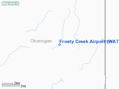
Location & QuickFacts
| FAA Information Effective: | 2008-09-25 |
| Airport Identifier: | WA70 |
| Airport Status: | Operational |
| Longitude/Latitude: | 118-59-05.1200W/48-34-39.5700N
-118.984756/48.577658 (Estimated) |
| Elevation: | 3608 ft / 1099.72 m () |
| Land: | 20 acres |
| From nearest city: | 19 nautical miles SE of Tonasket, WA |
| Location: | Okanogan County, WA |
| Magnetic Variation: | () |
Owner & Manager
| Ownership: | Privately owned |
| Owner: | Fred & Barbara Ellis |
| Address: | P.o. Box 698
Lopez Is., WA 98261 |
| Phone number: | 360-468-2047 |
| Manager: | Fred Ellis |
| Address: | P.o. Box 698
Lopez Is., WA 98261 |
| Phone number: | 360-468-2047 |
Airport Operations and Facilities
| Airport Use: | Private |
| Segmented Circle: | No |
| Control Tower: | No |
| Sectional chart: | Seattle |
| Region: | ANM - Northwest Mountain |
| Boundary ARTCC: | ZSE - Seattle |
| Tie-in FSS: | SEA - Seattle |
| FSS Toll Free: | 1-800-WX-BRIEF |
Runway Information
Runway 18/36
| Dimension: | 1200 x 230 ft / 365.8 x 70.1 m |
| Surface: | TURF, |
| |
Runway 18 |
Runway 36 |
| Traffic Pattern: | Left | Left |
| Obstruction: | 60 ft trees, 100.0 ft from runway | |
|
Radio Navigation Aids
| ID |
Type |
Name |
Ch |
Freq |
Var |
Dist |
| OMK | NDB | Omak | | 219.00 | 19E | 22.5 nm |
Images and information placed above are from
http://www.airport-data.com/airport/WA70/
We thank them for the data!
|
|


