 |
|
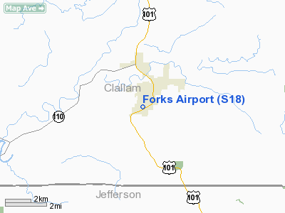
Location & QuickFacts
| FAA Information Effective: | 2008-09-25 |
| Airport Identifier: | S18 |
| Airport Status: | Operational |
| Longitude/Latitude: | 124-23-45.3140W/47-56-15.7860N
-124.395921/47.937718 (Estimated) |
| Elevation: | 299 ft / 91.14 m (Estimated) |
| Land: | 72 acres |
| From nearest city: | 1 nautical miles SW of Forks, WA |
| Location: | Clallam County, WA |
| Magnetic Variation: | 21E (1985) |
Owner & Manager
| Ownership: | Publicly owned |
| Owner: | City Of Forks |
| Address: | Forks City Hall, 500 East Division Street
Forks, WA 98331 |
| Phone number: | 360-374-5412 |
| Manager: | Dan Leinan |
| Address: | Forks City Hall, 500 East Division Street
Forks, WA 98331 |
| Phone number: | 360-374-5412
EXTENSION 240 |
Airport Operations and Facilities
| Airport Use: | Open to public |
| Control Tower: | No |
| Lighting Schedule: | DUSK-DAWN |
| Landing fee charge: | No |
| Sectional chart: | Seattle |
| Region: | ANM - Northwest Mountain |
| Boundary ARTCC: | ZSE - Seattle |
| Tie-in FSS: | SEA - Seattle |
| FSS on Airport: | No |
| FSS Toll Free: | 1-800-WX-BRIEF |
| NOTAMs Facility: | SEA (NOTAM-d service avaliable) |
| Federal Agreements: | GY |
Airport Communications
Airport Services
| Bottled Oxygen: | NONE |
| Bulk Oxygen: | NONE |
Runway Information
Runway 04/22
| Dimension: | 2400 x 75 ft / 731.5 x 22.9 m |
| Surface: | ASPH, Good Condition |
| Edge Lights: | Medium |
| |
Runway 04 |
Runway 22 |
| Traffic Pattern: | Left | Right |
| Markings: | Basic, Fair Condition | Basic, Fair Condition |
| Runway End Identifier: | Yes | Yes |
| Obstruction: | 51 ft tree, 300.0 ft from runway, 100 ft left of centerline, 1:1 slope to clear
ROW OF JERSEY BARRIERS 142' EAST OF CENTERLINE EXTENDING HALF THE LENGTH OF THE RUNWAY. | 30 ft tree, 290.0 ft from runway, 3:1 slope to clear |
|
Radio Navigation Aids
| ID |
Type |
Name |
Ch |
Freq |
Var |
Dist |
| CL | NDB | Elwha | | 515.00 | 22E | 31.8 nm |
| TOU | VORTAC | Tatoosh | 059X | 112.20 | 22E | 23.7 nm |
Remarks
- WILDLIFE ON & INVOF ARPT.
- ESTABD PRIOR TO 5/15/59.
Images and information placed above are from
http://www.airport-data.com/airport/S18/
We thank them for the data!
| General Info
|
| Country |
United States
|
| State |
WASHINGTON
|
| FAA ID |
S18
|
| Latitude |
47-56-29.277N
|
| Longitude |
124-23-34.752W
|
| Elevation |
296 feet
|
| Near City |
FORKS
|
We don't guarantee the information is fresh and accurate. The data may
be wrong or outdated.
For more up-to-date information please refer to other sources.
|
|


