 |
|
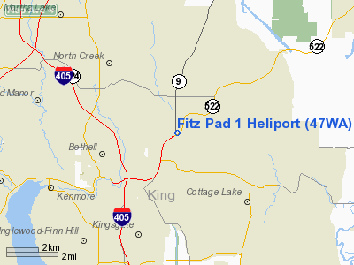
Location & QuickFacts
| FAA Information Effective: | 2008-09-25 |
| Airport Identifier: | 47WA |
| Airport Status: | Operational |
| Longitude/Latitude: | 122-08-31.0000W/47-47-03.0000N
-122.141944/47.784167 (Estimated) |
| Elevation: | 180 ft / 54.86 m (Estimated) |
| Land: | 9 acres |
| From nearest city: | 3 nautical miles N of Woodinville, WA |
| Location: | Snohomish County, WA |
| Magnetic Variation: | 20E (1995) |
Owner & Manager
| Ownership: | Privately owned |
| Owner: | Fitz Auto Parts Inc. |
| Address: | 23323 Highway 9 Se
Woodinville, WA 98072 |
| Phone number: | 206-483-1212 |
| Manager: | D.l. Fitzpatrick, Iii |
| Address: | 23323 Highway 9 Se
Woodinville, WA 98072 |
| Phone number: | 206-483-1212 |
Airport Operations and Facilities
| Airport Use: | Private |
| Wind indicator: | Yes |
| Segmented Circle: | No |
| Control Tower: | No |
| Sectional chart: | Seattle |
| Region: | ANM - Northwest Mountain |
| Boundary ARTCC: | ZSE - Seattle |
| Tie-in FSS: | SEA - Seattle |
| FSS on Airport: | No |
| FSS Toll Free: | 1-800-WX-BRIEF |
Airport Communications
Runway Information
Helipad H1
| Dimension: | 75 x 75 ft / 22.9 x 22.9 m |
| Surface: | GRVL, |
| |
Runway H1 |
Runway |
| Traffic Pattern: | Left | Left |
|
Radio Navigation Aids
| ID |
Type |
Name |
Ch |
Freq |
Var |
Dist |
| RNT | NDB | Renton | | 353.00 | 20E | 17.6 nm |
| ODD | NDB | Dondo | | 224.00 | 19E | 26.1 nm |
| PWT | NDB | Kitsap | | 206.00 | 20E | 30.5 nm |
| CAN | NDB | Carney | | 274.00 | 20E | 36.1 nm |
| GR | NDB | Graye | | 216.00 | 18E | 42.5 nm |
| BVS | NDB | Skagit/bay View | | 240.00 | 21E | 42.6 nm |
| LAC | NDB | Lacomas | | 328.00 | 18E | 49.6 nm |
| NUW | TACAN | Whidbey Island | 085X | | 21E | 40.2 nm |
| PAE | VOR/DME | Paine | 043X | 110.60 | 20E | 9.8 nm |
| CVV | VOR/DME | Penn Cove | 119X | 117.20 | 19E | 36.3 nm |
| SEA | VORTAC | Seattle | 115X | 116.80 | 19E | 22.0 nm |
| TCM | VORTAC | Mcchord | 033X | 109.60 | 22E | 40.6 nm |
| BFI | VOT | Boeing Field | | 108.60 | | 16.7 nm |
| SEA | VOT | Seattle-tacoma | | 117.50 | | 21.5 nm |
Images and information placed above are from
http://www.airport-data.com/airport/47WA/
We thank them for the data!
| General Info
|
| Country |
United States
|
| State |
WASHINGTON
|
| FAA ID |
47WA
|
| Latitude |
47-47-03.000N
|
| Longitude |
122-08-31.000W
|
| Elevation |
180 feet
|
| Near City |
WOODINVILLE
|
We don't guarantee the information is fresh and accurate. The data may
be wrong or outdated.
For more up-to-date information please refer to other sources.
|
|


