 |
|
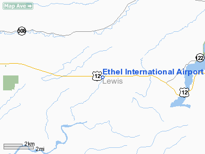
Location & QuickFacts
| FAA Information Effective: | 2008-09-25 |
| Airport Identifier: | WN34 |
| Airport Status: | Operational |
| Longitude/Latitude: | 122-41-02.4120W/46-31-51.3850N
-122.684003/46.530940 (Estimated) |
| Elevation: | 580 ft / 176.78 m (Estimated) |
| Land: | 6 acres |
| From nearest city: | 2 nautical miles E of Ethel, WA |
| Location: | Lewis County, WA |
| Magnetic Variation: | 20E (1985) |
Owner & Manager
| Ownership: | Privately owned |
| Owner: | Calvin Core |
| Address: | 1956 U S Highway No. 12
Ethel, WA 98542 |
| Phone number: | 206-985-2975 |
| Manager: | Calvin Core |
| Address: | 1956 U S Highway No. 12
Ethel, WA 98542 |
| Phone number: | 206-985-2975 |
Airport Operations and Facilities
| Airport Use: | Private |
| Wind indicator: | Yes |
| Segmented Circle: | No |
| Control Tower: | No |
| Landing fee charge: | No |
| Sectional chart: | Seattle |
| Region: | ANM - Northwest Mountain |
| Boundary ARTCC: | ZSE - Seattle |
| Tie-in FSS: | SEA - Seattle |
| FSS on Airport: | No |
| FSS Toll Free: | 1-800-WX-BRIEF |
Runway Information
Runway 07/25
| Dimension: | 1380 x 50 ft / 420.6 x 15.2 m |
| Surface: | TURF, Good Condition |
| |
Runway 07 |
Runway 25 |
| Traffic Pattern: | Right | Left |
|
Radio Navigation Aids
| ID |
Type |
Name |
Ch |
Freq |
Var |
Dist |
| TDO | NDB | Toledo | | 219.00 | 20E | 6.4 nm |
| LSO | NDB | Kelso | | 256.00 | 21E | 24.5 nm |
| LAC | NDB | Lacomas | | 328.00 | 18E | 29.1 nm |
| GR | NDB | Graye | | 216.00 | 18E | 37.4 nm |
| PEN | NDB | Karpen | | 201.00 | 20E | 44.3 nm |
| MNC | NDB | Mason County | | 348.00 | 19E | 46.2 nm |
| OLM | VORTAC | Olympia | 081X | 113.40 | 19E | 28.0 nm |
| TCM | VORTAC | Mcchord | 033X | 109.60 | 22E | 38.1 nm |
| BTG | VORTAC | Battle Ground | 113X | 116.60 | 21E | 47.2 nm |
Images and information placed above are from
http://www.airport-data.com/airport/WN34/
We thank them for the data!
| General Info
|
| Country |
United States
|
| State |
WASHINGTON
|
| FAA ID |
WN34
|
| Latitude |
46-31-51.385N
|
| Longitude |
122-41-02.412W
|
| Elevation |
580 feet
|
| Near City |
ETHEL
|
We don't guarantee the information is fresh and accurate. The data may
be wrong or outdated.
For more up-to-date information please refer to other sources.
|
|


