 |
|
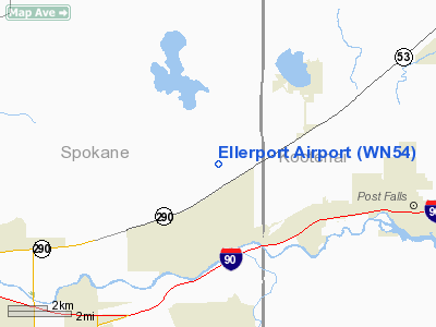
Location & QuickFacts
| FAA Information Effective: | 2008-09-25 |
| Airport Identifier: | WN54 |
| Airport Status: | Operational |
| Longitude/Latitude: | 117-04-16.7300W/47-44-05.6370N
-117.071314/47.734899 (Estimated) |
| Elevation: | 2146 ft / 654.10 m (Surveyed) |
| Land: | 5 acres |
| From nearest city: | 1 nautical miles S of Newman Lake, WA |
| Location: | Spokane County, WA |
| Magnetic Variation: | 19E (1985) |
Owner & Manager
| Ownership: | Privately owned |
| Owner: | C. T. Eller |
| Address: | Po Box 151
Newman Lake, WA 99025 |
| Phone number: | 509-226-3588 |
| Manager: | C. T. Eller |
| Address: | Po Box 151
Newman Lake, WA 99025 |
| Phone number: | 509-226-3588 |
Airport Operations and Facilities
| Airport Use: | Private |
| Wind indicator: | Yes |
| Segmented Circle: | No |
| Control Tower: | No |
| Lighting Schedule: | RDO-CTL
ACTVT LIRL RYS 01 & 19 - 122.9. |
| Sectional chart: | Seattle |
| Region: | ANM - Northwest Mountain |
| Boundary ARTCC: | ZSE - Seattle |
| Tie-in FSS: | SEA - Seattle |
| FSS on Airport: | No |
| FSS Toll Free: | 1-800-WX-BRIEF |
Runway Information
Runway 01/19
| Dimension: | 3800 x 60 ft / 1158.2 x 18.3 m
RY 01/19 EXTDD EQUALLY BOTH ENDS. |
| Surface: | ASPH, Good Condition |
| Edge Lights: | Low |
| |
Runway 01 |
Runway 19 |
| Traffic Pattern: | Left | Left |
| Obstruction: | 250 ft hill, 600.0 ft from runway | |
|
Radio Navigation Aids
| ID |
Type |
Name |
Ch |
Freq |
Var |
Dist |
| SFF | NDB | Felts | | 365.00 | 19E | 10.2 nm |
| DPY | NDB | Deer Park | | 216.00 | 19E | 20.0 nm |
| SZT | NDB | Sandpoe | | 264.00 | 20E | 39.2 nm |
| SKA | TACAN | Fairchild | 051X | | 19E | 25.1 nm |
| COE | VOR/DME | Coeur D'alene | 025X | 108.80 | 19E | 10.4 nm |
| GEG | VORTAC | Spokane | 102X | 115.50 | 21E | 24.7 nm |
| SFF | VOT | Spokane/felts Field | | 114.00 | | 10.6 nm |
| GEG | VOT | Spokane Intl | | 109.60 | | 20.2 nm |
Remarks
- RECOMMENDED TKOF, LAND SOUTH.
Images and information placed above are from
http://www.airport-data.com/airport/WN54/
We thank them for the data!
| General Info
|
| Country |
United States
|
| State |
WASHINGTON
|
| FAA ID |
WN54
|
| Latitude |
47-44-05.637N
|
| Longitude |
117-04-16.730W
|
| Elevation |
2146 feet
|
| Near City |
NEWMAN LAKE
|
We don't guarantee the information is fresh and accurate. The data may
be wrong or outdated.
For more up-to-date information please refer to other sources.
|
|


