 |
|
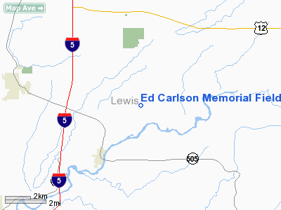
Ed Carlson Memorial Field - South Lewis Co Airport |
Location & QuickFacts
| FAA Information Effective: | 2008-09-25 |
| Airport Identifier: | TDO |
| Airport Status: | Operational |
| Longitude/Latitude: | 122-48-22.2700W/46-28-38.0260N
-122.806186/46.477229 (Estimated) |
| Elevation: | 374 ft / 114.00 m (Surveyed) |
| Land: | 170 acres |
| From nearest city: | 3 nautical miles N of Toledo, WA |
| Location: | Lewis County, WA |
| Magnetic Variation: | 20E (1985) |
Owner & Manager
| Ownership: | Publicly owned |
| Owner: | Lewis County |
| Address: | 2025 Ne Kresky Ave
Chehalis, WA 98532 |
| Phone number: | 360-740-2606 |
| Manager: | Larry Mason |
| Address: | 826 Cinebar Road
Cinebar, WA 98533-9732 |
| Phone number: | 360-864-4966 |
Airport Operations and Facilities
| Airport Use: | Open to public |
| Wind indicator: | Yes |
| Segmented Circle: | No |
| Control Tower: | No |
| Lighting Schedule: | DUSK-DAWN
ACTVT MIRL RY 05/23 & REIL RYS 05 & 23 - CTAF. SAVASI RY 05 & PAPI RY 23 OPR 24 HRS. |
| Beacon Color: | Clear-Green (lighted land airport) |
| Landing fee charge: | No |
| Sectional chart: | Seattle |
| Region: | ANM - Northwest Mountain |
| Boundary ARTCC: | ZSE - Seattle |
| Tie-in FSS: | SEA - Seattle |
| FSS on Airport: | No |
| FSS Toll Free: | 1-800-WX-BRIEF |
| NOTAMs Facility: | TDO (NOTAM-d service avaliable) |
| Federal Agreements: | N3 |
Airport Communications
Airport Services
| Fuel available: | 100
24 HR CREDIT CARD FUEL FAC. |
| Airframe Repair: | MAJOR |
| Power Plant Repair: | MAJOR |
| Bottled Oxygen: | NONE |
| Bulk Oxygen: | NONE |
Runway Information
Runway 05/23
| Dimension: | 4480 x 150 ft / 1365.5 x 45.7 m |
| Surface: | ASPH, Good Condition |
| Weight Limit: | Single wheel: 25000 lbs. |
| Edge Lights: | Medium |
| |
Runway 05 |
Runway 23 |
| Longitude: | 122-48-54.0380W | 122-47-52.6010W |
| Latitude: | 46-28-31.6020N | 46-28-44.0050N |
| Elevation: | 356.00 ft | 374.00 ft |
| Alignment: | 74 | 127 |
| Traffic Pattern: | Left | Left |
| Markings: | Basic, Good Condition | Basic, Good Condition |
| Crossing Height: | 40.00 ft | 40.00 ft |
| VASI: | 2-box SAVASI on left side | 2-light PAPI on left side |
| Visual Glide Angle: | 3.00° | 3.00° |
| Runway End Identifier: | Yes | Yes |
| Obstruction: | 20 ft windcone, 410.0 ft from runway, 250 ft left of centerline, 10:1 slope to clear | 4 ft fence, 300.0 ft from runway, 25:1 slope to clear |
|
Radio Navigation Aids
| ID |
Type |
Name |
Ch |
Freq |
Var |
Dist |
| TDO | NDB | Toledo | | 219.00 | 20E | 0.5 nm |
| LSO | NDB | Kelso | | 256.00 | 21E | 19.8 nm |
| LAC | NDB | Lacomas | | 328.00 | 18E | 33.5 nm |
| PEN | NDB | Karpen | | 201.00 | 20E | 38.3 nm |
| GR | NDB | Graye | | 216.00 | 18E | 41.3 nm |
| MNC | NDB | Mason County | | 348.00 | 19E | 47.7 nm |
| AST | VOR/DME | Astoria | 087X | 114.00 | 19E | 48.5 nm |
| OLM | VORTAC | Olympia | 081X | 113.40 | 19E | 30.0 nm |
| TCM | VORTAC | Mcchord | 033X | 109.60 | 22E | 42.5 nm |
| BTG | VORTAC | Battle Ground | 113X | 116.60 | 21E | 44.7 nm |
Remarks
- RADIO CONTROLLED ACFT ADJACENT RY 05/23 400 FT & BLO.
- DISTANCE TO GO MARKERS SOUTHSIDE OF RY.
- ARPT ESTABD PRIOR TO 1959.
Images and information placed above are from
http://www.airport-data.com/airport/TDO/
We thank them for the data!
| General Info
|
| Country |
United States
|
| State |
WASHINGTON
|
| FAA ID |
TDO
|
| Latitude |
46-28-37.527N
|
| Longitude |
122-48-24.696W
|
| Elevation |
375 feet
|
| Near City |
TOLEDO
|
We don't guarantee the information is fresh and accurate. The data may
be wrong or outdated.
For more up-to-date information please refer to other sources.
|
|


