 |
|
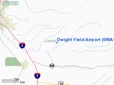
Location & QuickFacts
| FAA Information Effective: | 2008-09-25 |
| Airport Identifier: | 0WA1 |
| Airport Status: | Operational |
| Longitude/Latitude: | 122-49-34.4360W/46-37-01.3770N
-122.826232/46.617049 (Estimated) |
| Elevation: | 350 ft / 106.68 m (Surveyed) |
| Land: | 30 acres |
| From nearest city: | 5 nautical miles SE of Chehalis, WA |
| Location: | Lewis County, WA |
| Magnetic Variation: | 20E (1985) |
Owner & Manager
| Ownership: | Privately owned |
| Owner: | J.m. Dwight |
| Address: | 414 Hewitt Road
Chehalis, WA 98532-8601 |
| Phone number: | 206-262-9844 |
| Manager: | J.m. Dwight |
| Address: | 414 Hewitt Road
Chehalis, WA 98532-8601 |
| Phone number: | 206-262-9404 |
Airport Operations and Facilities
| Airport Use: | Private |
| Wind indicator: | Yes |
| Segmented Circle: | No |
| Control Tower: | No |
| Sectional chart: | Seattle |
| Region: | ANM - Northwest Mountain |
| Boundary ARTCC: | ZSE - Seattle |
| Tie-in FSS: | SEA - Seattle |
| FSS Toll Free: | 1-800-WX-BRIEF |
Airport Services
Runway Information
Runway 16/34
| Dimension: | 2000 x 50 ft / 609.6 x 15.2 m |
| Surface: | TURF, |
| |
Runway 16 |
Runway 34 |
| Traffic Pattern: | Left | Right |
| Obstruction: | 40 ft pline, 150.0 ft from runway | 80 ft trees, 260.0 ft from runway |
|
Radio Navigation Aids
| ID |
Type |
Name |
Ch |
Freq |
Var |
Dist |
| TDO | NDB | Toledo | | 219.00 | 20E | 8.5 nm |
| LAC | NDB | Lacomas | | 328.00 | 18E | 26.0 nm |
| LSO | NDB | Kelso | | 256.00 | 21E | 28.0 nm |
| GR | NDB | Graye | | 216.00 | 18E | 33.3 nm |
| MNC | NDB | Mason County | | 348.00 | 19E | 39.4 nm |
| PEN | NDB | Karpen | | 201.00 | 20E | 42.7 nm |
| CAN | NDB | Carney | | 274.00 | 20E | 47.7 nm |
| ODD | NDB | Dondo | | 224.00 | 19E | 49.7 nm |
| OLM | VORTAC | Olympia | 081X | 113.40 | 19E | 21.5 nm |
| TCM | VORTAC | Mcchord | 033X | 109.60 | 22E | 35.0 nm |
Images and information placed above are from
http://www.airport-data.com/airport/0WA1/
We thank them for the data!
| General Info
|
| Country |
United States
|
| State |
WASHINGTON
|
| FAA ID |
0WA1
|
| Latitude |
46-37-01.377N
|
| Longitude |
122-49-34.436W
|
| Elevation |
350 feet
|
| Near City |
CHEHALIS
|
We don't guarantee the information is fresh and accurate. The data may
be wrong or outdated.
For more up-to-date information please refer to other sources.
|
|


