 |
|
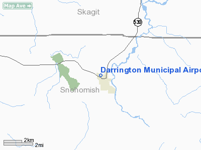
Location & QuickFacts
| FAA Information Effective: | 2008-09-25 |
| Airport Identifier: | 1S2 |
| Airport Status: | Operational |
| Longitude/Latitude: | 121-36-36.7330W/48-15-31.0050N
-121.610204/48.258612 (Estimated) |
| Elevation: | 553 ft / 168.55 m (Estimated) |
| Land: | 90 acres |
| From nearest city: | 0 nautical miles N of Darrington, WA |
| Location: | Snohomish County, WA |
| Magnetic Variation: | 21E (1985) |
Owner & Manager
| Ownership: | Publicly owned |
| Owner: | Town Of Darrington |
| Address: | P.o. Box 397
Darrington, WA 98241 |
| Phone number: | 360-436-1131 |
| Manager: | Jim Hale |
| Address: | P.o. Box 397
Darrington, WA 98241 |
| Phone number: | 360-436-1454 |
Airport Operations and Facilities
| Airport Use: | Open to public |
| Wind indicator: | Yes |
| Segmented Circle: | No |
| Control Tower: | No |
| Lighting Schedule: | DUSK-DAWN
ACTVT MIRL RY 10/28 - CTAF. |
| Beacon Color: | Clear-Green (lighted land airport) |
| Landing fee charge: | No |
| Sectional chart: | Seattle |
| Region: | ANM - Northwest Mountain |
| Boundary ARTCC: | ZSE - Seattle |
| Tie-in FSS: | SEA - Seattle |
| FSS on Airport: | No |
| FSS Toll Free: | 1-800-WX-BRIEF |
| NOTAMs Facility: | SEA (NOTAM-d service avaliable) |
Airport Communications
Airport Services
| Airframe Repair: | NONE |
| Power Plant Repair: | NONE |
| Bottled Oxygen: | NONE |
| Bulk Oxygen: | NONE |
Runway Information
Runway 10/28
| Dimension: | 2491 x 40 ft / 759.3 x 12.2 m |
| Surface: | ASPH, Good Condition |
| Edge Lights: | Medium
MIRL RY 10/28 OTS INDEFLY. |
| |
Runway 10 |
Runway 28 |
| Longitude: | 121-36-53.9600W | 121-36-19.5070W |
| Latitude: | 48-15-35.3390N | 48-15-26.6710N |
| Elevation: | 544.00 ft | 553.00 ft |
| Alignment: | 111 | 127 |
| Traffic Pattern: | Left | Left |
| Markings: | Nonstandard,
HAS SMALL NUMBERS ONLY. | ,
HAS NO MARKINGS. |
| Obstruction: | 4 ft fence, 200.0 ft from runway, 29 ft right of centerline | 15 ft road, 305.0 ft from runway, 126 ft left of centerline, 7:1 slope to clear |
|
Radio Navigation Aids
| ID |
Type |
Name |
Ch |
Freq |
Var |
Dist |
| BVS | NDB | Skagit/bay View | | 240.00 | 21E | 34.7 nm |
| LU | NDB | Cultus | | 214.00 | 22E | 49.0 nm |
| NUW | TACAN | Whidbey Island | 085X | | 21E | 42.4 nm |
| PAE | VOR/DME | Paine | 043X | 110.60 | 20E | 33.7 nm |
| CVV | VOR/DME | Penn Cove | 119X | 117.20 | 19E | 44.6 nm |
Remarks
- CLSD WHEN SNOW ON RY.
- TURB ON HOT DAYS LNDG W BTN ROWS OF TREES IN TRSN.
- TWYS MARKED WITH BLUE REFLECTORS.
- ESTABD PRIOR TO 15 MAY 1959.
Images and information placed above are from
http://www.airport-data.com/airport/1S2/
We thank them for the data!
| General Info
|
| Country |
United States
|
| State |
WASHINGTON
|
| FAA ID |
1S2
|
| Latitude |
48-15-29.391N
|
| Longitude |
121-36-34.451W
|
| Elevation |
543 feet
|
| Near City |
DARRINGTON
|
We don't guarantee the information is fresh and accurate. The data may
be wrong or outdated.
For more up-to-date information please refer to other sources.
|
|


